
Image: Christchurch private tramway route map
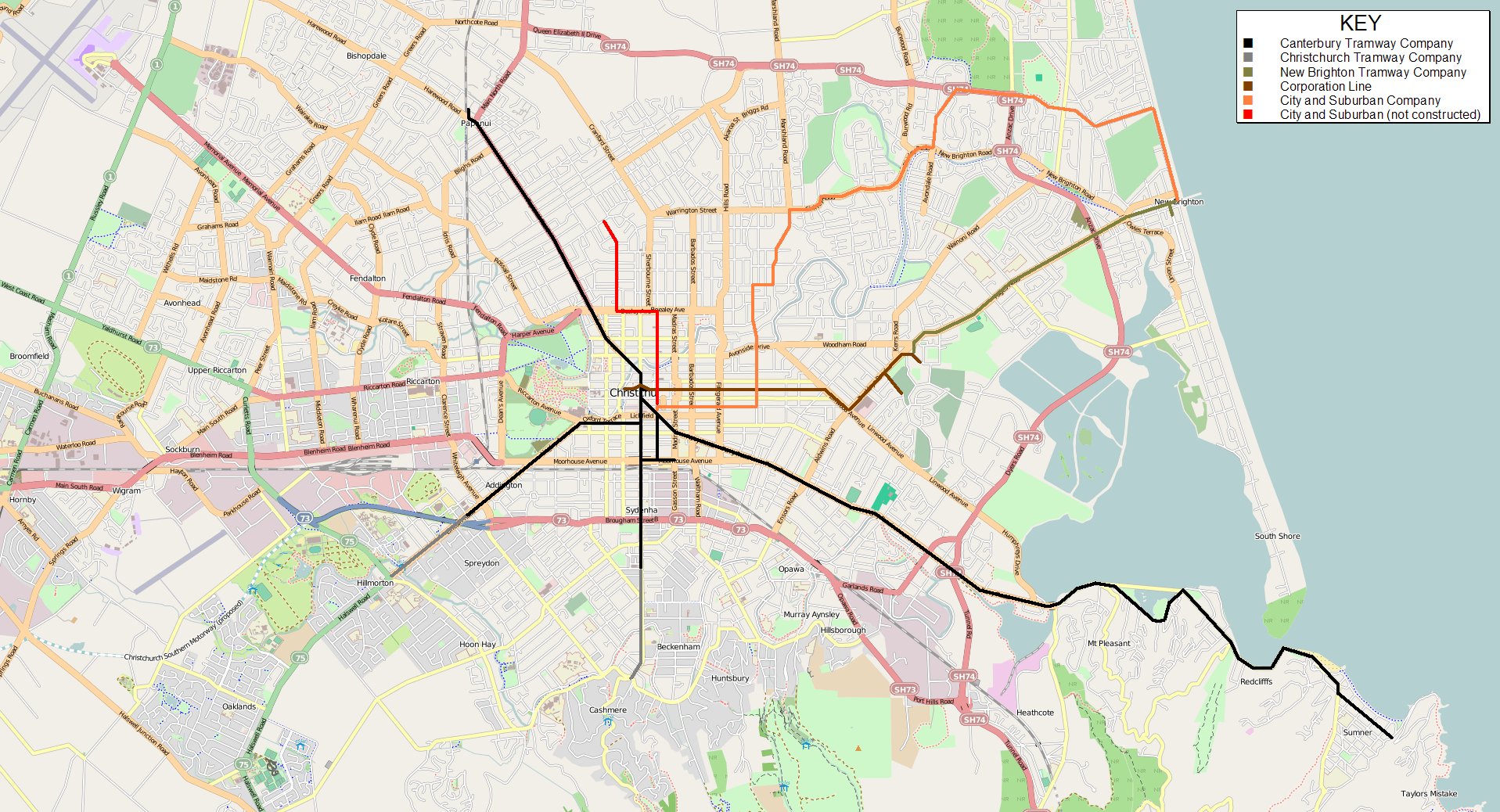
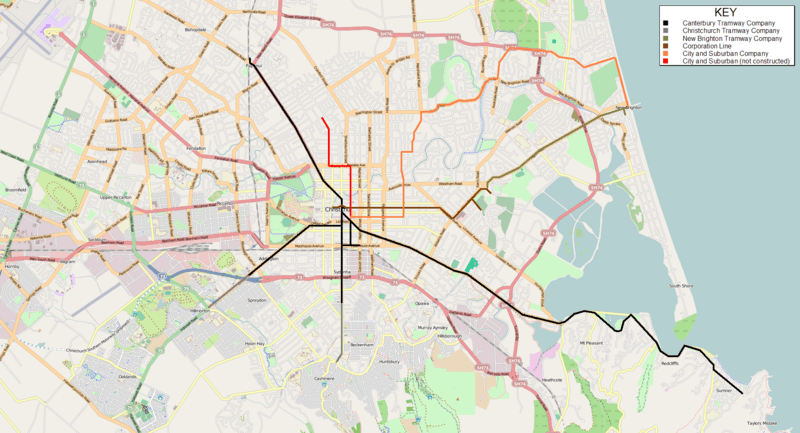
Description: Route map of the private era tramway system in Christchurch, New Zealand (1880–1906). N.B. The base road map used here is for reference only and no attempt has been made to make it commensurate with the era in which the tramway operated. Disclaimer: Whilst I have endeavoured to ensure the accuracy of the route information, there may be instances where it is not 100% historically accurate, especially where the original line passed through undeveloped or open terrain.
Title: Christchurch private tramway route map
Credit: Own work based on map image from OpenStreetMap. Route information courtesy of: Alexander, Mark (1985) Rails in the Roads: The steam and horse tram era in Christchurch, Christchurch: Christchurch Transport Board Stewart, Graham (1993) The End Of The Penny Section: When Trams Ruled the Streets of New Zealand, Wellington: Grantham House Publishing Transferred from en.wikipedia by SreeBot
Author: Matthew25187 at en.wikipedia
Permission: Base map image © OpenStreetMap contributors, CC-BY-SA.
Usage Terms: Creative Commons Attribution-Share Alike 3.0
License: CC BY-SA 3.0
License Link: https://creativecommons.org/licenses/by-sa/3.0
Attribution Required?: Yes
Image usage
The following page links to this image:
