
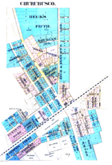
Image: Churubusco Indiana 1889 Plat Map

Size of this preview: 407 × 599 pixels. Other resolutions: 163 × 240 pixels | 1,241 × 1,826 pixels.
Original image (1,241 × 1,826 pixels, file size: 1.7 MB, MIME type: image/png)
Description: Whitley County, Indiana - 1889 plat map of Churubusco
Title: Churubusco Indiana 1889 Plat Map
Credit: Allen County Public Library archives, Fort Wayne, Indiana
Usage Terms: Public domain in the United States
License: PD-US
License Link: //en.wikipedia.org/wiki/File:Churubusco_Indiana_1889_Plat_Map.png
Image usage
The following page links to this image:

All content from Kiddle encyclopedia articles (including the article images and facts) can be freely used under Attribution-ShareAlike license, unless stated otherwise.