
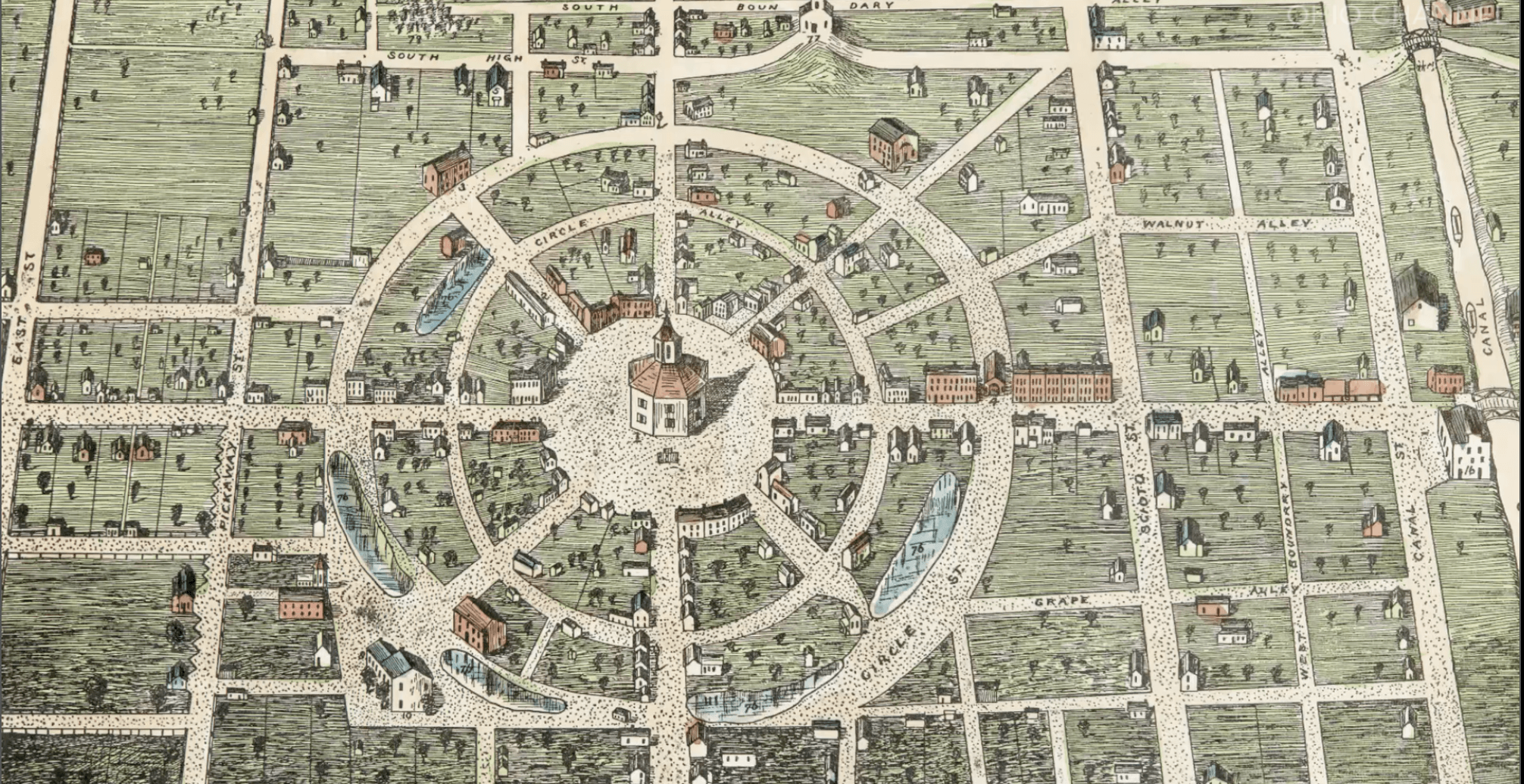
Image: Circleville map
Size of this preview: 800 × 412 pixels. Other resolutions: 320 × 165 pixels | 2,012 × 1,036 pixels.
Original image (2,012 × 1,036 pixels, file size: 1.6 MB, MIME type: image/png)
Description: Map of Circleville in watercolor from c. 1836.
Title: Circleville map
Credit: http://www.ohiochannel.org/video/ohio-county-courthouses-seats-of-justice-pickaway-county
Author: 1836 map of Circleville by Mr. G. F. Wittich, see https://babel.hathitrust.org/cgi/pt?id=msu.31293104537158;view=1up;seq=197 page 181.
Usage Terms: Public domain
License: Public domain
Attribution Required?: No
Image usage
The following page links to this image:

All content from Kiddle encyclopedia articles (including the article images and facts) can be freely used under Attribution-ShareAlike license, unless stated otherwise.