
Image: Circular walk from Solva to St Elvis and Dinas Fawr (37) - geograph.org.uk - 1532880
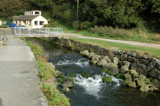
Description: Circular walk from Solva to St Elvis and Dinas Fawr (37) This series of photos portrays a 2-mile circular walk east and south of Solva, Pembrokeshire. Initially, the walk climbs out of the valley of the River Solva onto The Gribbin, a knife-edge ridge between the glacial valleys of Solva and Gwadn. The walk then descends to a marshy area before climbing inland to farmland. Near St Elvis Farm, the walk passes a cromlech (a neolithic burial chamber) then heads to the coastpath and turns west to follow the clifftop. After descending into Gwadn cove, the walk climbs to rejoin The Gribbin before descending into Solva. The route can be followed on OS 1:50000 sheet 157 or on OS 'Explorer' 1:25000 sheet OL35. The last half-mile has been a descent from The Gribbin ridge through woodland and the walk ends here where it began beside the River Solva. Ahead is the footbridge from the carpark which was crossed at the start of the walk. Previous [1]
Title: Circular walk from Solva to St Elvis and Dinas Fawr (37) - geograph.org.uk - 1532880
Credit: From geograph.org.uk
Author: Andy F
Usage Terms: Creative Commons Attribution-Share Alike 2.0
License: CC BY-SA 2.0
License Link: https://creativecommons.org/licenses/by-sa/2.0
Attribution Required?: Yes
Image usage
The following page links to this image:

_-_geograph.org.uk_-_1532880.jpg)