
Image: City of London Ward Map, 1870

Size of this PNG preview of this SVG file: 800 × 528 pixels. Other resolution: 320 × 211 pixels.
Original image (SVG file, nominally 1,213 × 801 pixels, file size: 88 KB)
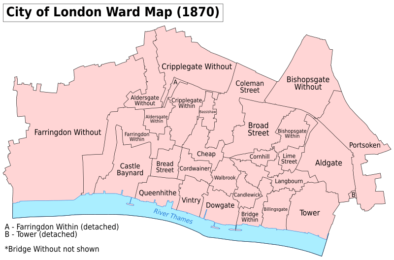
Description: A map showing the wards of the City of London as they appeared in 1870. Based on the Ordnance Survey Town Plan of London (1871-76) at 1:1056 scale. Accessed at https://www.old-maps.co.uk/#/. Key: District Boundaries River bank River
Title: City of London Ward Map, 1870
Credit: Own work
Author: Doc77can
Usage Terms: Creative Commons Attribution-Share Alike 4.0
License: CC BY-SA 4.0
License Link: http://creativecommons.org/licenses/by-sa/4.0
Attribution Required?: Yes
Image usage
The following 3 pages link to this image:

All content from Kiddle encyclopedia articles (including the article images and facts) can be freely used under Attribution-ShareAlike license, unless stated otherwise.