
Image: Closed I-695 off-ramp - northbound Sousa Bridge - Washington DC
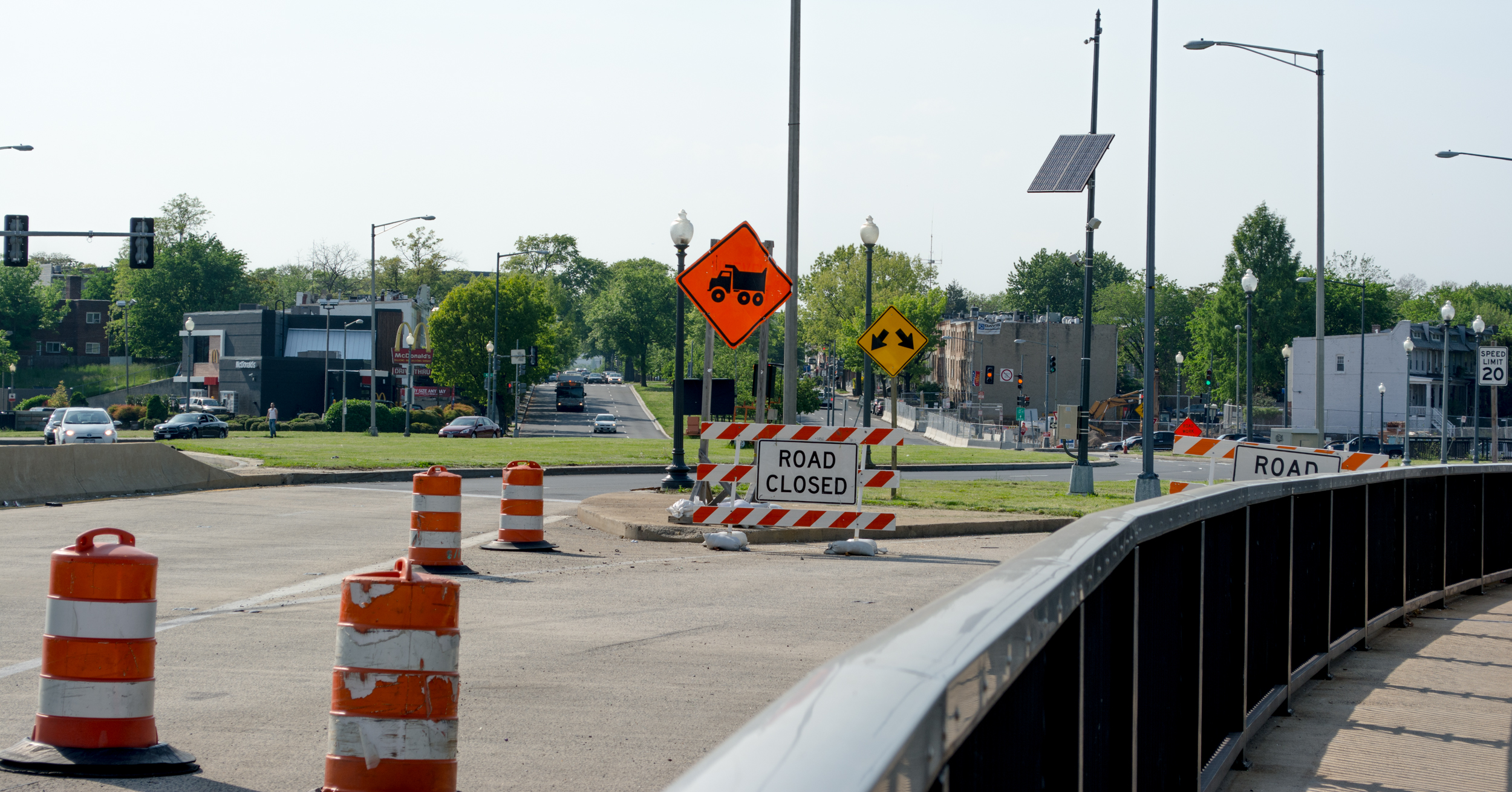
Description: Looking northwest from John Philip Sousa Bridge in Washington, D.C., in the United States in May 2014 at the now-unused off-ramp to Interstate 695, and at Barney Circle. Interstate 695 was part of the proposed Inner Loop Expressway in Washington, D.C. The interstate highway was to have continued northward along the western shore of the Anacostia River to U.S. Route 50. Significant opposition to the Inner Loop led to its cancellation, but not before the portion of Interstate 695 from 2nd Street SW to Barney Circle had already been completed. The tunnels beneath the circle and bridge were constructed in 1970 as part of the interstate project. Crudely planned off-ramps led from northbound Sousa Bridge to Interstate 695 westbound. Interstate 695 from the 11th Street Bridges to Barney Circle was decommissioned in 2012, and the off-ramp permanently closed. The dark roadway is Pennsylvania Avenue SE, which passes in a slight curving motion through Barney Circle before straightening out in a northwest direction. Traffic is approaching Barney Circle in the distance on southbound Pennsylvania Avenue SE.
Title: Closed I-695 off-ramp - northbound Sousa Bridge - Washington DC
Credit: https://www.flickr.com/photos/23165290@N00/14155442295
Author: Tim Evanson
Usage Terms: Creative Commons Attribution-Share Alike 2.0
License: CC BY-SA 2.0
License Link: https://creativecommons.org/licenses/by-sa/2.0
Attribution Required?: Yes
Image usage
The following page links to this image:
