
Image: Coles Creek culture map HRoe 2010
No higher resolution available.
Coles_Creek_culture_map_HRoe_2010.jpg (600 × 525 pixels, file size: 253 KB, MIME type: image/jpeg)
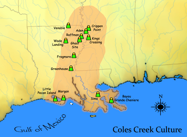
Description: A map showing the geographical extent of the Coles Creek cultural phase in the Southern United States, and some of its important sites.
Title: Coles Creek culture map HRoe 2010
Credit: Own work Herb Roe www.chromesun.com
Author: Heironymous Rowe
Usage Terms: Creative Commons Attribution-Share Alike 3.0
License: CC BY-SA 3.0
License Link: http://creativecommons.org/licenses/by-sa/3.0
Attribution Required?: Yes
Image usage
The following 7 pages link to this image:

All content from Kiddle encyclopedia articles (including the article images and facts) can be freely used under Attribution-ShareAlike license, unless stated otherwise.