
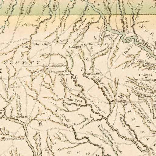
Image: Collet Map excerpt Bute County
No higher resolution available.
Collet_Map_excerpt_Bute_County.jpeg (512 × 512 pixels, file size: 66 KB, MIME type: image/jpeg)
Description: An excerpt of John Collet's 1770 map of North Carolina depicting several plantations and settlements in Bute County.
Title: Collet Map excerpt Bute County
Credit: University of North Carolina Digital Collections: http://dc.lib.unc.edu/cdm/ref/collection/ncmaps/id/467
Author: John Collet, J. Bayly, S. Hooper
Usage Terms: Public domain
License: Public domain
Attribution Required?: No
Image usage
The following 2 pages link to this image:

All content from Kiddle encyclopedia articles (including the article images and facts) can be freely used under Attribution-ShareAlike license, unless stated otherwise.