
Image: Colonisation2
Size of this preview: 799 × 350 pixels. Other resolutions: 320 × 140 pixels | 1,849 × 810 pixels.
Original image (1,849 × 810 pixels, file size: 2.08 MB, MIME type: image/gif, looped, 12 frames, 48 s)
Note: Due to technical limitations, thumbnails of high resolution GIF images such as this one will not be animated.
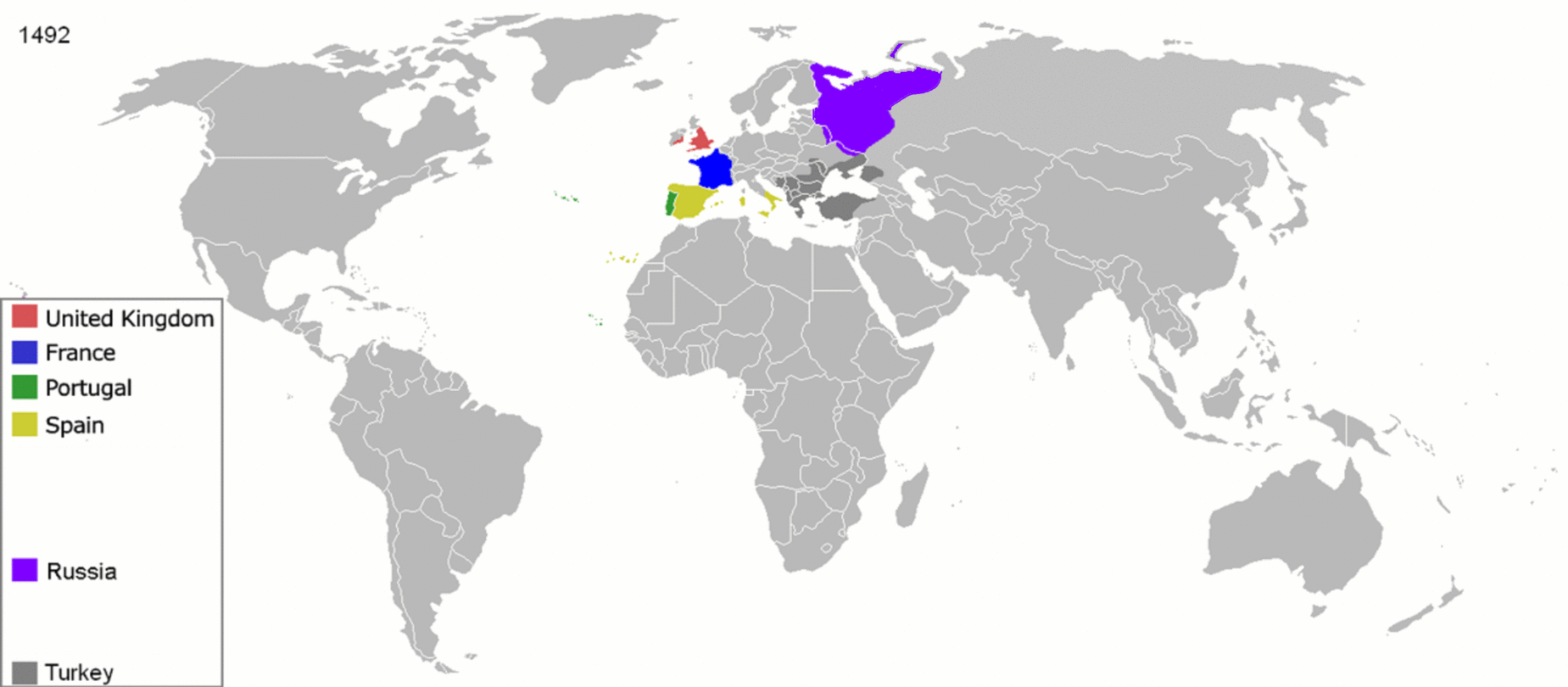
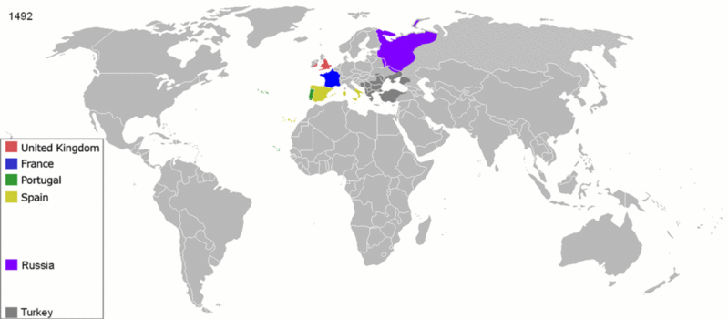
Description: Map indicating the territories colonized by the European powers, United States and Japan.
Title: Colonisation2
Credit: Transferred from en.wikipedia to Commons.
Author: Andrei nacu at English Wikipedia
Usage Terms: Public domain
License: Public domain
Attribution Required?: No
Image usage
The following 3 pages link to this image:

All content from Kiddle encyclopedia articles (including the article images and facts) can be freely used under Attribution-ShareAlike license, unless stated otherwise.