
Image: Colonisation 1550
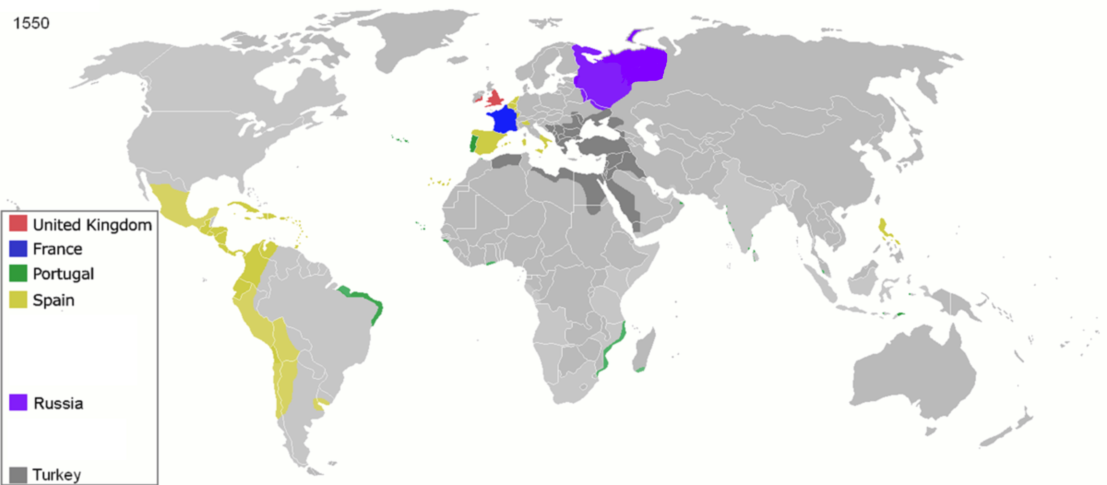
Description: Map of major world powers by year Maps of world history BC 2000 · 1000 · 500 · 400 · 323 · 300 · 200 · 100 · 50 AD 1 · 50 · 100 · 200 · 250 · 300 · 400 · 500 · 700 · 750 · 820 · 900 · 1959 · 1980 · Maps of colonization history 1492 · 1550 · 1660 · 1754 · 1800 · 1812 · 1822 · 1885 · 1898 · 1914 · 1920 · 1936 · 1938 · 1945 · 1959 · 1974 · 1975 · 2007 Animated Map see also: Eastern Hemisphere only maps template (1300BC-1500AD) (this template: · view · discuss ) As the orriginal licence of the animation was Public Domain, this image which has been derived from it is too: This work has been released into the public domain by its author, Andrei nacu. This applies worldwide. In some countries this may not be legally possible; if so: Andrei nacu grants anyone the right to use this work for any purpose, without any conditions, unless such conditions are required by law.
Title: Colonisation 1550
Credit: public domain animated map by Andrei nacu here
Author: Andrei nacu
Usage Terms: Public domain
License: Public domain
Attribution Required?: No
Image usage
The following page links to this image:
