
Image: Comancheria
No higher resolution available.
Comancheria.jpg (585 × 571 pixels, file size: 139 KB, MIME type: image/jpeg)
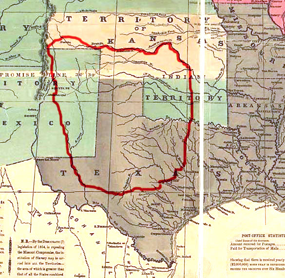
Description: Map showing approximately the area, known as Comancheria, occupied by the various Comanche tribes prior to 1850. It's made using "Reynolds's Political Map of the United States" (1856) from Library of Congress collection (public domain).
Title: Comancheria
Credit: No machine-readable source provided. Own work assumed (based on copyright claims).
Author: No machine-readable author provided. Left Hook~commonswiki assumed (based on copyright claims).
Usage Terms: Public domain
License: Public domain
Attribution Required?: No
Image usage
The following 12 pages link to this image:

All content from Kiddle encyclopedia articles (including the article images and facts) can be freely used under Attribution-ShareAlike license, unless stated otherwise.