
Image: Concord Expedition and Patriot Messengers
Size of this preview: 800 × 341 pixels. Other resolutions: 320 × 136 pixels | 1,000 × 426 pixels.
Original image (1,000 × 426 pixels, file size: 139 KB, MIME type: image/jpeg)
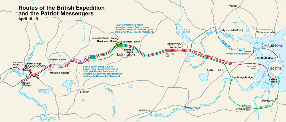
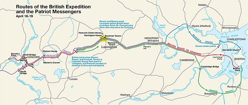
Description: This is a map depiction the outbound routes taken by Patriot riders and British troops in the Battles of Lexington and Concord on April 19, 1775.
Title: Concord Expedition and Patriot Messengers
Credit: From the National Park Service: http://data2.itc.nps.gov/parks/mima/ppMaps/MIMAmap2.pdf
Author: United States National Park Service
Usage Terms: Public domain
License: Public domain
Attribution Required?: No
Image usage
The following page links to this image:

All content from Kiddle encyclopedia articles (including the article images and facts) can be freely used under Attribution-ShareAlike license, unless stated otherwise.