
Image: Conquest mexico 1519 21
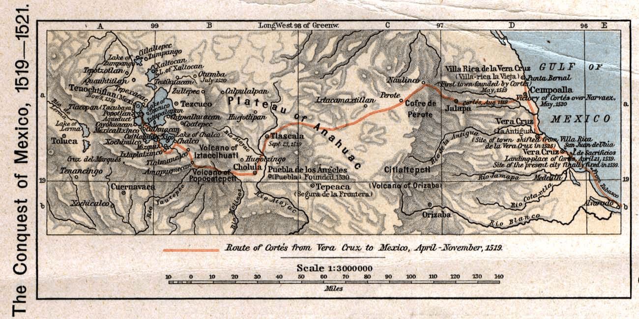
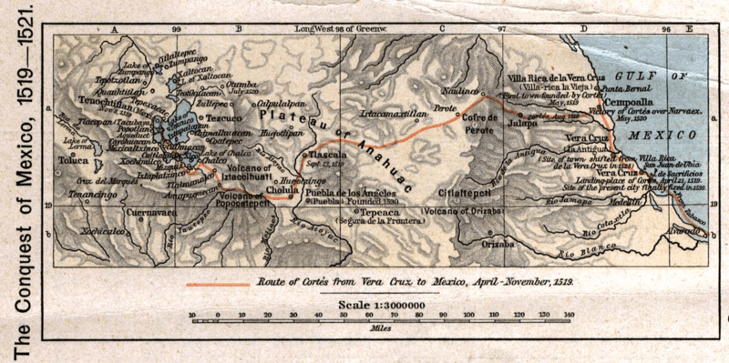
Description: The 1519 to 1521 route of the Spanish conquest of the Aztec Empire — taken in Central Mexico by Hernando Cortes. Scan from "Historical Atlas" by William R. Shepherd, New York, Henry Holt and Company, 1926 ed. Original image at the Perry-Castañeda Library Map Collection at the en:University of Texas at Austin website: http://www.lib.utexas.edu/maps/historical/shepherd/conquest_mexico_1519_21.jpg From the FAQ @ http://www.lib.utexas.edu/maps/faq.html Most of the maps scanned by the University of Texas Libraries and served from this web site are in the public domain. No permissions are needed to copy them. You may download them and use them as you wish. A few maps are copyrighted, and are clearly marked as such. Any that are copyrighted by The University of Texas are subject to our Materials Usage Guidelines. This map is not so marked.
Title: Conquest mexico 1519 21
Usage Terms: Public domain
License: Public domain
Attribution Required?: No
Image usage
The following page links to this image:
