
Image: Constantinople conference west
Size of this preview: 315 × 599 pixels. Other resolutions: 126 × 240 pixels | 2,000 × 3,804 pixels.
Original image (2,000 × 3,804 pixels, file size: 1.88 MB, MIME type: image/jpeg)
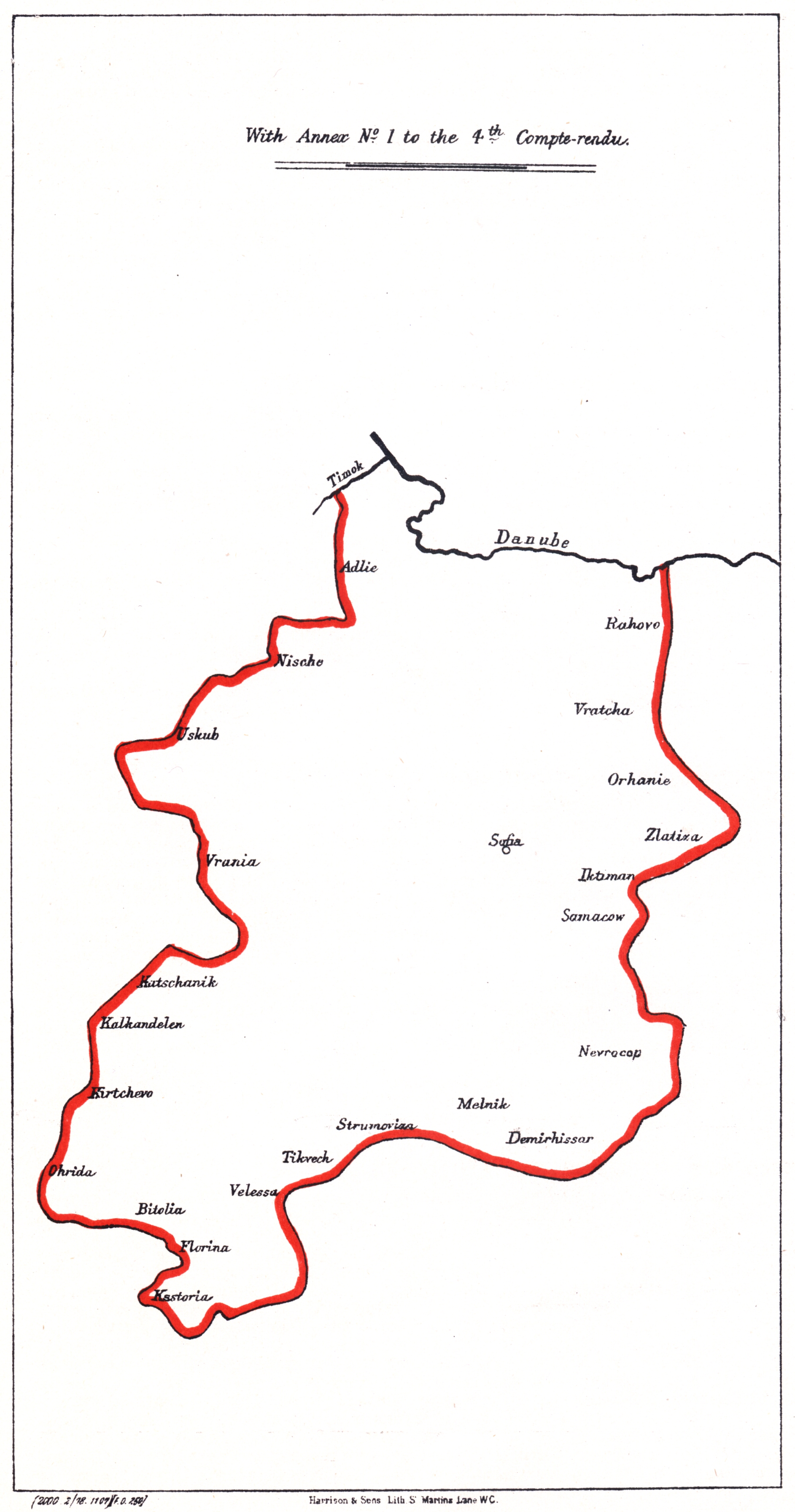
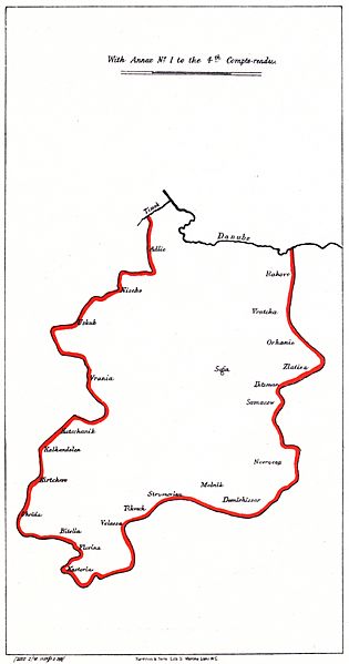
Description: Map of the Western Bulgarian Autonomous province, proposed by the en:Constantinople Conference (1876)
Title: Constantinople conference west
Credit: Blue book 13 "Further Correspondence respecting the affairs of Turkey. (With Maps of proposed Bulgarian Vilayets)
Usage Terms: Public domain
License: Public domain
Attribution Required?: No
Image usage
The following page links to this image:

All content from Kiddle encyclopedia articles (including the article images and facts) can be freely used under Attribution-ShareAlike license, unless stated otherwise.