
Image: Cooks Karte von Neufundland

Size of this preview: 615 × 599 pixels. Other resolutions: 246 × 240 pixels | 1,500 × 1,462 pixels.
Original image (1,500 × 1,462 pixels, file size: 521 KB, MIME type: image/jpeg)
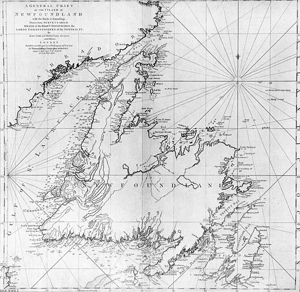
Description: A general chart of the island of Newfoundland. Surveyed by James Cook and Michael Lane, and "publish'd according to Act of Parliament by Thomas Jefferys Geographer to the King, 1775."
Title: Cooks Karte von Neufundland
Credit: originally uploaded to en.wikipedia by Jcmurphy on 23 Apr 2005; copied from "Courtesy of the Centre for Newfoundland Studies, Memorial University of Newfoundland, St. John's, Newfoundland."
Author: Michael Lane and James Cook
Permission: Public domain because of age
Usage Terms: Public domain
License: Public domain
Attribution Required?: No
Image usage
The following 3 pages link to this image:

All content from Kiddle encyclopedia articles (including the article images and facts) can be freely used under Attribution-ShareAlike license, unless stated otherwise.