
Image: Cork Harbour RMG K0967
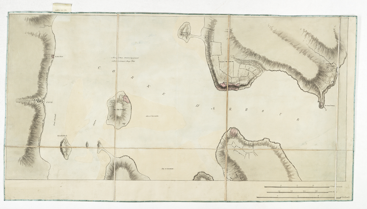
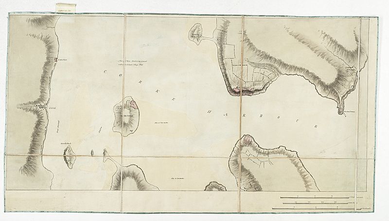
Description: [Cork Harbour]Single sheet, manuscript. Segmented and backed. Scale: 1:12,000. North at 270 degrees. The chart marks areas which dry at low water. The scale is in English miles, Irish miles, and feet. Additional Places: Cobh, Ireland. There is a note to the effect that the Men of War anchoring ground will not contain a large fleet. Gren2C/5 [Cork Harbour]
Title: Cork Harbour RMG K0967
Credit: http://collections.rmg.co.uk/collections/objects/541882
Author: Unknown authorUnknown author
Permission: The original artefact or artwork has been assessed as public domain by age, and faithful reproductions of the two dimensional work are also public domain. No permission is required for reuse for any purpose. The text of this image record has been derived from the Royal Museums Greenwich catalogue and image metadata. Individual data and facts such as date, author and title are not copyrightable, but reuse of longer descriptive text from the catalogue may not be considered fair use. Reuse of the text must be attributed to the "National Maritime Museum, Greenwich, London" and a Creative Commons CC-BY-NC-SA-3.0 license may apply if not rewritten. Refer to Royal Museums Greenwich copyright.
Usage Terms: Public domain
License: Public domain
Attribution Required?: No
Image usage
The following page links to this image:
