
Image: Cornwall UK district map (numbered)

Size of this PNG preview of this SVG file: 800 × 588 pixels. Other resolution: 320 × 235 pixels.
Original image (SVG file, nominally 1,425 × 1,048 pixels, file size: 1.1 MB)
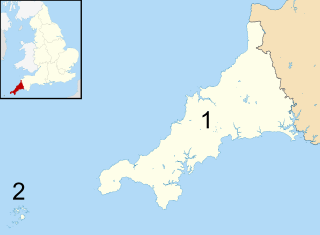
Description: Map of Cornwall, UK with districts numbered. Equirectangular map projection on WGS 84 datum, with N/S stretched 150% Geographic limits: West: 6.47W East: 4.00W North: 51.04N South: 49.83N
Title: Cornwall UK district map (numbered)
Credit: This file was derived from: Cornwall UK district map (blank).svg
Author: Ordnance Survey OpenData. Most data from Boundary-Line product. Lake data from Meridian 2 product. Inset derived from England location map.svg by Spischot, original file by Nilfanion
Usage Terms: Creative Commons Attribution-Share Alike 3.0
License: CC BY-SA 3.0
License Link: https://creativecommons.org/licenses/by-sa/3.0
Attribution Required?: Yes
Image usage
The following page links to this image:

All content from Kiddle encyclopedia articles (including the article images and facts) can be freely used under Attribution-ShareAlike license, unless stated otherwise.
.svg)