
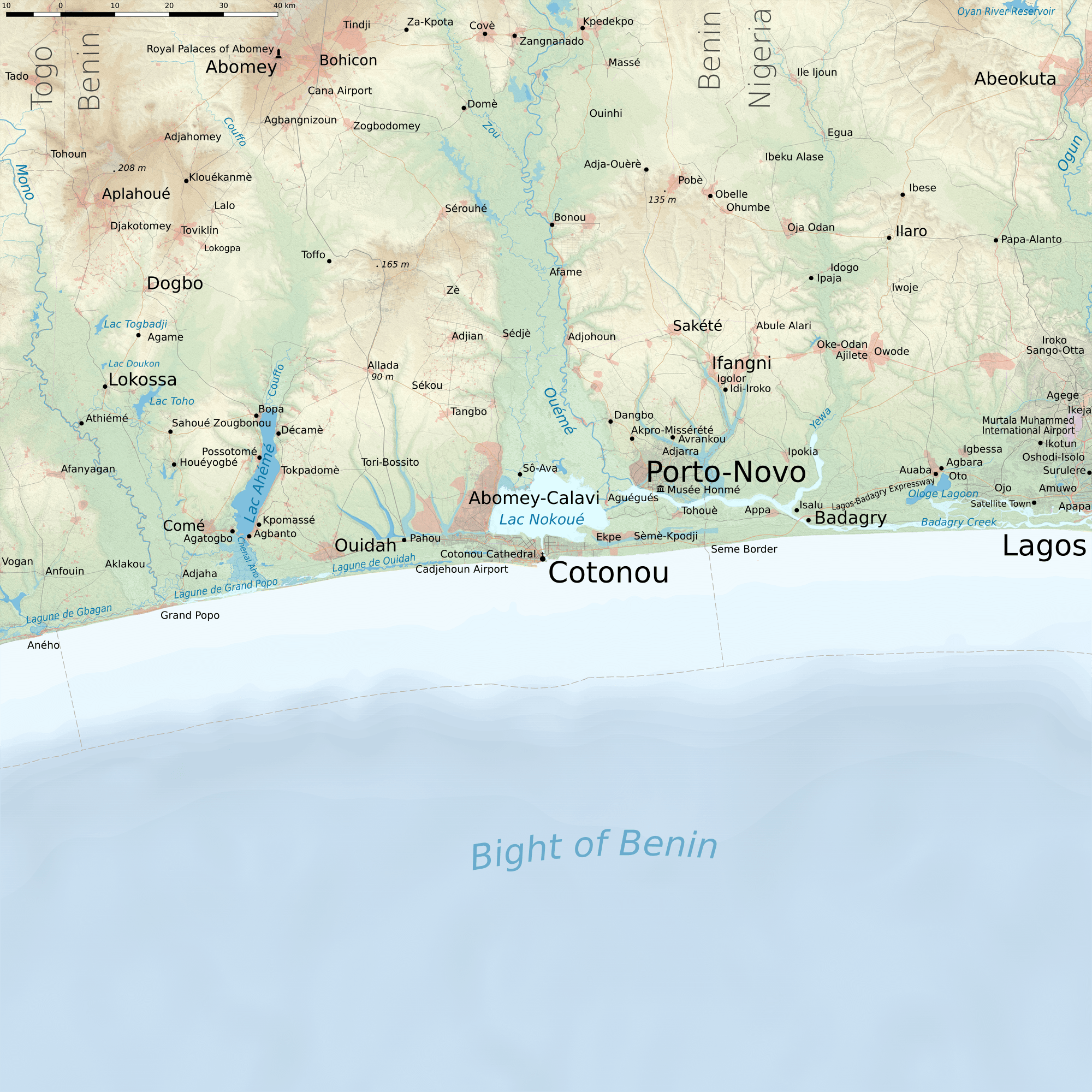
Image: Cotonou terrain
Description: Map of Cotonou and surroundings. Projection: WGS 84 / Pseudo Mercator, EPSG: 3857. Legend: motorway trunk road primary road secondary road tertiary road unclassified road other road/track/path aeroway power line railway_rail boundary admin_level_2 natural_water wetland sand/beach dam canal ditch drain river important river stream allotments cemetery construction educational quarry governmental greenfield industrial landfill military commercial railway residential retail park aeroway amenity -2000 m -1000 m -750 m -500 m -250 m -100 m -50 m -20 m 0 m depression 1 m 15 m 30 m 45 m 60 m 75 m 80 m 95 m 110 m 135 m 150 m 175 m 200 m 225 m 250 m 275 m
Title: Cotonou terrain
Credit: Own work + Openstreetmap, SRTM, ETOPO1, Wikipedia articles, Wikivoyage articles, US Army Map 1:1000000, Russian Military Map 1:500000 for some spot heights, http://www.dailytrust.com.ng/news/feature/corruption-thrives-at-nigeria-s-borders/127163.html
Author: Metropolcarte
Usage Terms: Creative Commons Attribution-Share Alike 4.0
License: CC BY-SA 4.0
License Link: http://creativecommons.org/licenses/by-sa/4.0
Attribution Required?: Yes
Image usage
There are no pages that link to this image.
