
Image: County Lock, River Kennet, Reading - geograph.org.uk - 381837
No higher resolution available.
County_Lock,_River_Kennet,_Reading_-_geograph.org.uk_-_381837.jpg (640 × 530 pixels, file size: 95 KB, MIME type: image/jpeg)
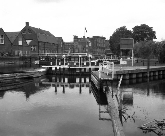
Description: County Lock, River Kennet, Reading County Lock is the lowest of the BWB locks on the Kennet Navigation. It is situated in an urban area with only one more lock (Blake's Lock, administered by the Thames authority) just a few hundred yards below it and the same distance above the point (Kennet Mouth) where the Kennet disgorges into the River Thames.
Title: County Lock, River Kennet, Reading - geograph.org.uk - 381837
Credit: From geograph.org.uk
Author: Dr Neil Clifton
Usage Terms: Creative Commons Attribution-Share Alike 2.0
License: CC BY-SA 2.0
License Link: https://creativecommons.org/licenses/by-sa/2.0
Attribution Required?: Yes
Image usage
The following page links to this image:

All content from Kiddle encyclopedia articles (including the article images and facts) can be freely used under Attribution-ShareAlike license, unless stated otherwise.