
Image: Crug Hywel - Table Mountain - geograph.org.uk - 222159
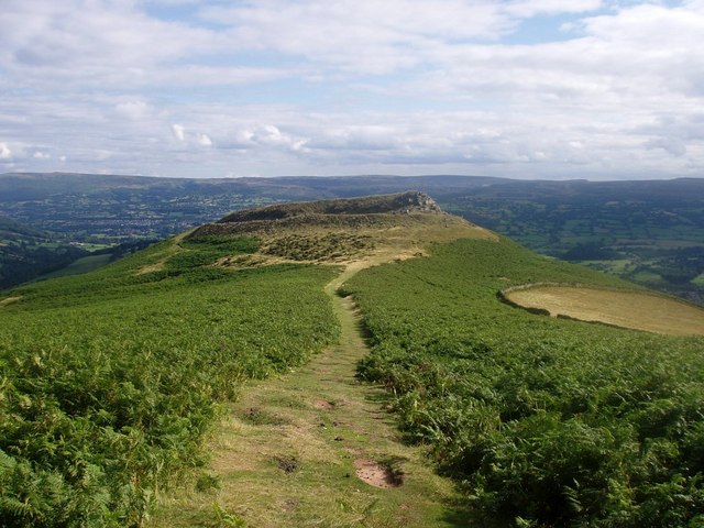
Description: Atlas of Hillforts 1474 Crug Hywel / Table Mountain. Table mountain is rather grandiosely named, being just an outcrop on the south side of Pen Cerrig Calch (222150). It was used as a hill fort during the Iron Age - it must have been the obvious choice for that purpose at the time due to its large level surface surrounded by crags on almost all sides! Crickhowell (123586), the town below, was named after the fort. The area surrounding Table Mountain to W, S and E is enclosed farmland.
Title: Crug Hywel - Table Mountain - geograph.org.uk - 222159
Credit: From geograph.org.uk
Author: Rudi Winter
Usage Terms: Creative Commons Attribution-Share Alike 2.0
License: CC BY-SA 2.0
License Link: https://creativecommons.org/licenses/by-sa/2.0
Attribution Required?: Yes
Image usage
The following page links to this image:
