
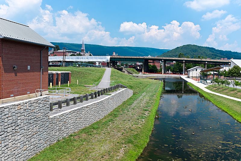
Image: Cumberland Basin looking North

Size of this preview: 800 × 533 pixels. Other resolutions: 320 × 213 pixels | 4,896 × 3,264 pixels.
Original image (4,896 × 3,264 pixels, file size: 9.83 MB, MIME type: image/jpeg)
Description: This is the basin at the end of the Chesapeake and Ohio Canal, looking north toward the end of the canal. Guard lock #8 is at the end of the channel on the left. Interstate Highway 68 / US 40 / US 220 runs on that bridge in the background. The Western Maryland Station is just visiable (brick building) beyond the highway bridge. Shops at Canal Place are to the right of the basin. Potomac River is to the left, just beyond the flood wall.
Title: Cumberland Basin looking North
Credit: Own work
Author: Bonnachoven
Usage Terms: Creative Commons Zero, Public Domain Dedication
License: CC0
License Link: http://creativecommons.org/publicdomain/zero/1.0/deed.en
Attribution Required?: No
Image usage
The following 2 pages link to this image:

All content from Kiddle encyclopedia articles (including the article images and facts) can be freely used under Attribution-ShareAlike license, unless stated otherwise.