
Image: Cumberland Narrows air

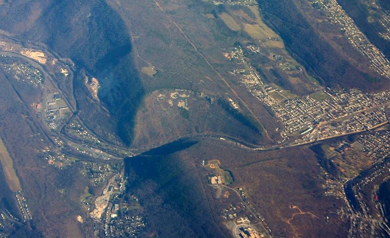
Description: Oblique air photo of Cumberland Narrows (a water gap), facing northeast, December 10, 2006. Wills Mountain is at top, Haystack Mountain (Maryland) is at bottom. The anticlinal structure of the Tuscarora Formation (sandstone layer at top and sides of the mountain) is apparent in this photo. w:U.S. Route 40 Alternate and the National Road & historic Cumberland Road runs through the pass from and above w:Cumberland, Maryland, as did the historic Baltimore and Ohio Railroad's tracks to the Monongahela Valley in Pennsylvania passing through the Cumberland Narrows pass above Cumberland, Maryland. The Western Maryland Railroad also ran track through the gap.
Title: Cumberland Narrows air
Credit: Own work Transferred from en.wikipedia to Commons.
Author: Jstuby at English Wikipedia
Usage Terms: Public domain
License: Public domain
Attribution Required?: No
Image usage
The following page links to this image:
