
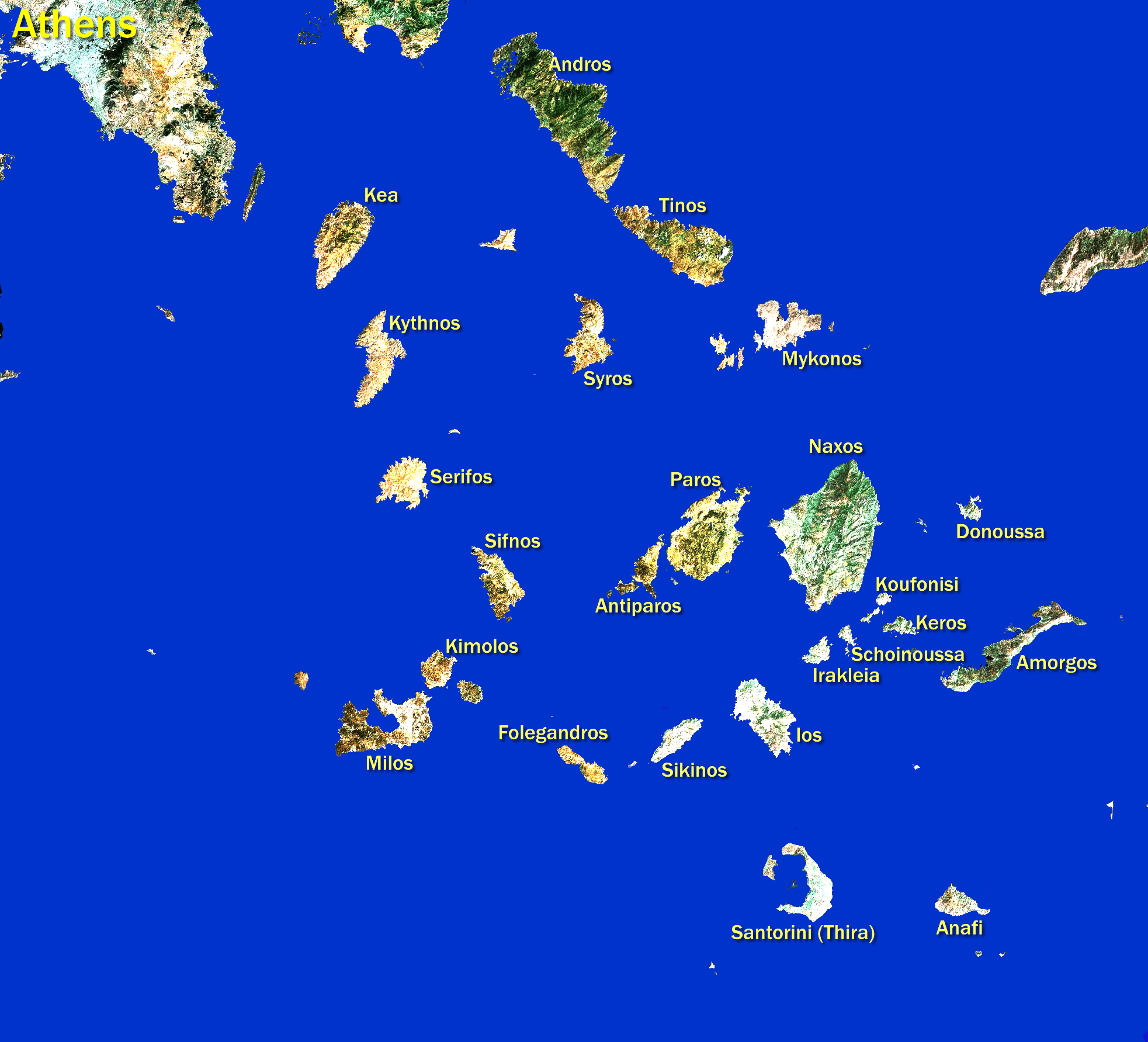
Image: Cyclades-Satellite
Size of this preview: 661 × 600 pixels. Other resolutions: 265 × 240 pixels | 1,965 × 1,783 pixels.
Original image (1,965 × 1,783 pixels, file size: 1.83 MB, MIME type: image/png)
Title: Cyclades-Satellite
Credit: Satellite image as used by Google Maps but modified by removing sea, brightening land, and adding island names. Own work (Original text: All modifications are by me.) Transferred from en.wikipedia to Commons by User:Dorieo.
Author: Henryhartley at en.wikipedia
Permission: Since the satellite image is originally a NASA image, I believe this is a legal use.
Usage Terms: GNU Free Documentation License
License: GFDL
License Link: http://www.gnu.org/copyleft/fdl.html
Attribution Required?: Yes
Image usage
The following page links to this image:

All content from Kiddle encyclopedia articles (including the article images and facts) can be freely used under Attribution-ShareAlike license, unless stated otherwise.