
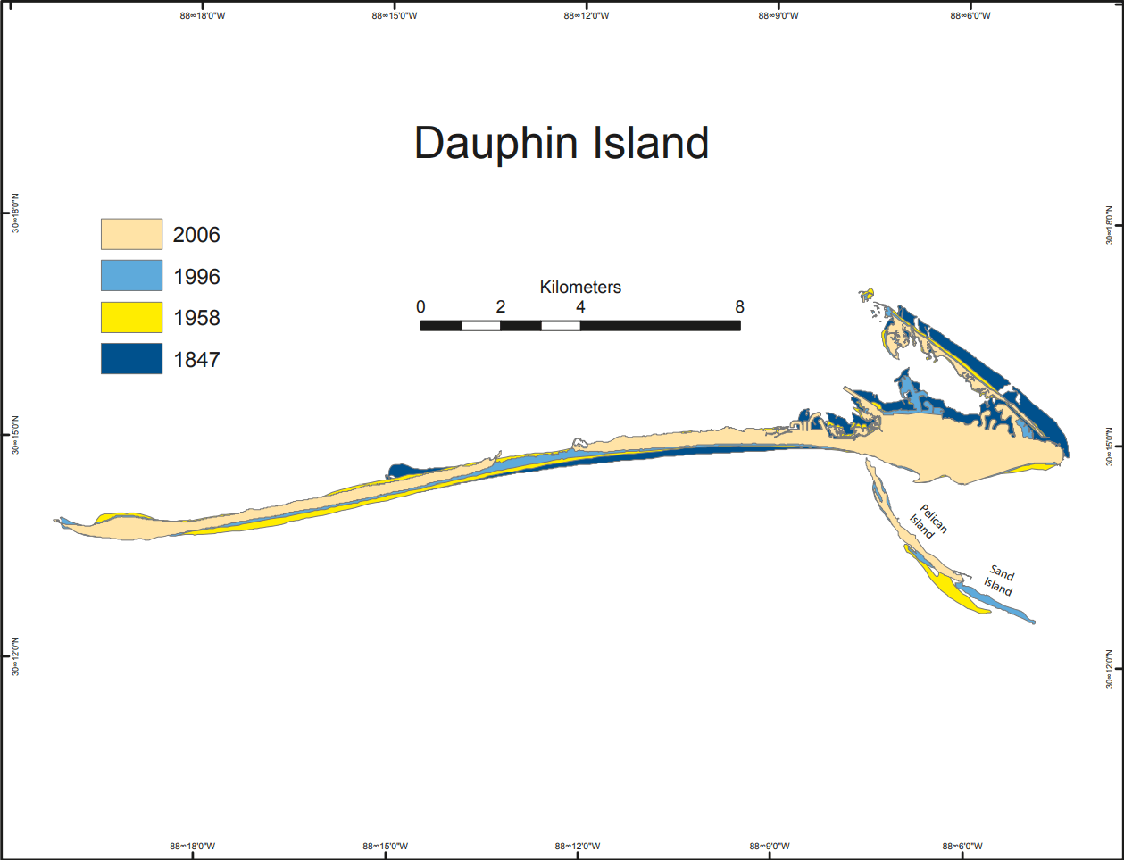
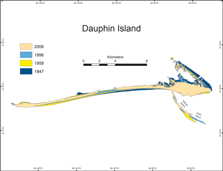
Image: Dauphin Island map
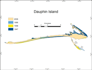
Size of this preview: 784 × 600 pixels. Other resolutions: 314 × 240 pixels | 1,259 × 963 pixels.
Original image (1,259 × 963 pixels, file size: 108 KB, MIME type: image/png)
Description: Historical geomorphology of Dauphin Island, Alabama, showing the shoreline at various dates
Title: Dauphin Island map
Credit: Morton, Robert A.. 8, 2020 Historical Changes in the Mississippi–Alabama Barrier Islands and the Roles of Extreme Storms, Sea Level, and Human Activities. USGS Publications Warehouse. United States Geological Survey.
Author: Robert A. Morton U.S. Geological Survey
Usage Terms: Public domain
License: Public domain
Attribution Required?: No
Image usage
The following page links to this image:

All content from Kiddle encyclopedia articles (including the article images and facts) can be freely used under Attribution-ShareAlike license, unless stated otherwise.