
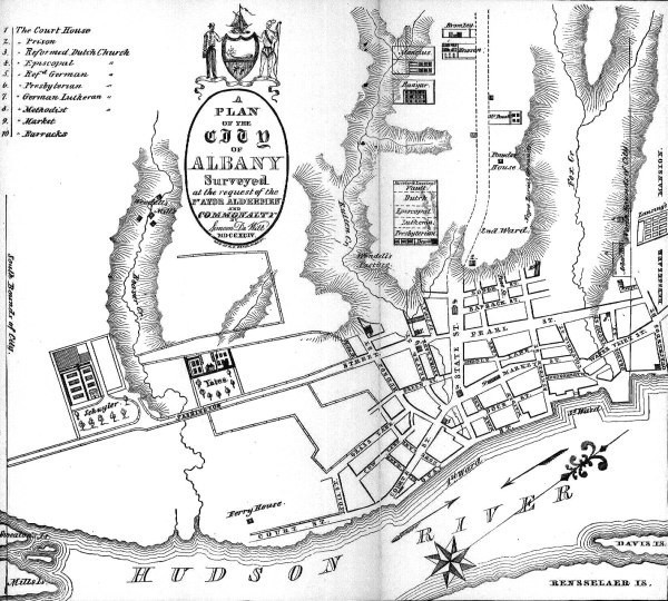
Image: DeWittmapofAlbany1790
No higher resolution available.
DeWittmapofAlbany1790.jpg (600 × 540 pixels, file size: 127 KB, MIME type: image/jpeg)
Description: Map made by Simeon De Witt in 1790, used as a base map for the planning of future streets in Albany, NY
Title: DeWittmapofAlbany1790
Credit: http://www.nysm.nysed.gov/albany/map/mapdewitt.html
Author: Simeon De Witt
Permission: Author died over 70 years ago
Usage Terms: Public domain
License: Public domain
Attribution Required?: No
Image usage
The following page links to this image:

All content from Kiddle encyclopedia articles (including the article images and facts) can be freely used under Attribution-ShareAlike license, unless stated otherwise.