
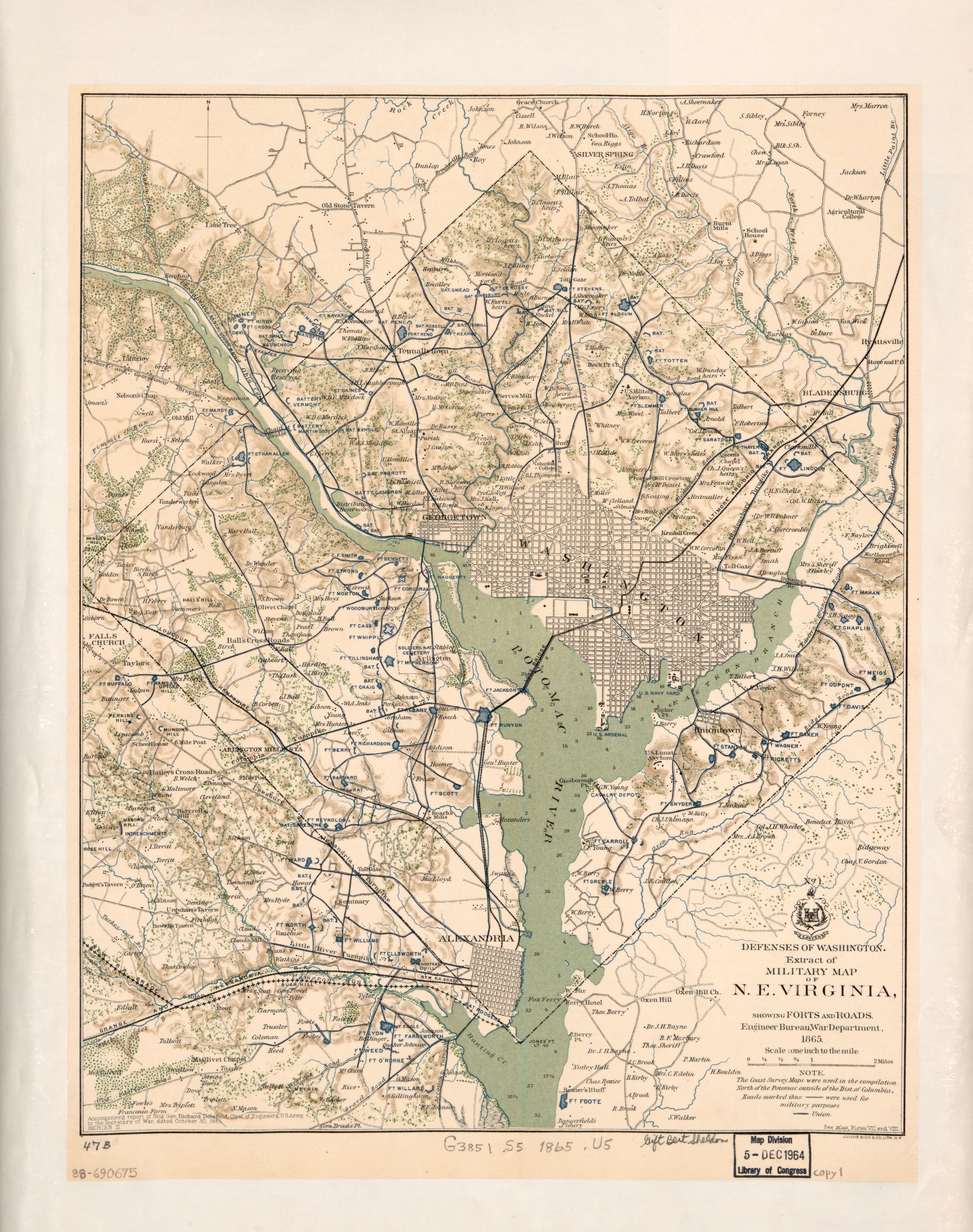
Image: Defenses of Washington, extract of military map of N.E. Virginia - showing forts and roads LOC 88690675
Description: Relief shown by hachures. Depths shown by soundings. Also shows woods and householders' names in rural areas. In lower left corner: Accompanying report of Brig. Gen. Richard Delafield ... dated October 30, 1865, series III. From: Atlas to accompany the official records of the Union and Confederate Armies, Washington, 1891-1895, plate 89, map 1. In lower right corner: See Atlas, Plates VII. and VIII. Includes note and coat of arms. At head of coat of arms: No. 1. LC copy 1 laminated and mounted on cloth backing; copy 2 fold-lined and mounted on paper backing. Available also through the Library of Congress Web site as a raster image. 3 copies DCP
Title: Defenses of Washington, extract of military map of N.E. Virginia - showing forts and roads LOC 88690675
Credit: https://www.loc.gov/item/88690675/
Author: United States. War Department. Engineer Bureau; Delafield, Richard; United States. Government Printing Office
Permission: This map is available from the United States Library of Congress's Geography & Map Division under the digital ID g3851s.la002308. This tag does not indicate the copyright status of the attached work. A normal copyright tag is still required. See Commons:Licensing for more information.
Usage Terms: Public domain
License: Public domain
Attribution Required?: No
Image usage
The following 3 pages link to this image:
