
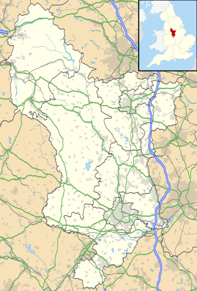
Image: Derbyshire UK location map

Description: Map of Derbyshire, UK with the following information shown: Administrative borders Coastline, lakes and rivers Roads and railways Urban areas Equirectangular map projection on WGS 84 datum, with N/S stretched 165% Geographic limits: West: 2.06W East: 1.10W North: 53.55N South: 52.69N
Title: Derbyshire UK location map
Credit: Ordnance Survey OpenData. Administrative borders and coastline data from Boundary-Line product. All other geographic data from Meridian 2 product. Inset derived from England location map.svg by Spischot.
Author: Nilfanion, created using Ordnance Survey data
Permission: This file is licensed under the Creative Commons Attribution-Share Alike 3.0 Unported license. Attribution: Contains Ordnance Survey data © Crown copyright and database right You are free: to share – to copy, distribute and transmit the work to remix – to adapt the work Under the following conditions: attribution – You must attribute the work in the manner specified by the author or licensor (but not in any way that suggests that they endorse you or your use of the work). share alike – If you alter, transform, or build upon this work, you may distribute the resulting work only under the same or similar license to this one. http://creativecommons.org/licenses/by-sa/3.0 CC BY-SA 3.0 Creative Commons Attribution-Share Alike 3.0 truetrue
Usage Terms: Creative Commons Attribution-Share Alike 3.0
License: CC BY-SA 3.0
License Link: http://creativecommons.org/licenses/by-sa/3.0
Attribution Required?: Yes
Image usage
More than 100 pages link to this image. The following list shows the first 100 page links to this image only. A full list is available.
- Alfreton
- All Saints' Church, Bakewell
- All Saints' Church, Curbar
- All Saints' Church, Matlock Bank
- Ambergate
- Ardotalia
- Ashbourne, Derbyshire
- Barbrook One
- Barrow Camera
- Belper Baptist Church
- Belper Congregational Church
- Belper North Mill
- Bolsover
- Bradbourne Priory
- Breadsall Priory
- Bugsworth Basin
- Buxton
- Cave Dale
- Chesterfield, Derbyshire
- Christ Church, Holloway
- Codnor Castle
- Crich
- Cromford Mill
- Dale Abbey
- Dale Abbey (ruin)
- Darley Abbey
- Darley Dale
- Derby Blackfriars
- Derventio Coritanorum
- Doe Lea
- Doll Tor
- Dronfield
- Edale
- Errwood Hall
- Glossop
- Gresley Priory
- Haarlem Mill
- Heanor
- High Peak Estate
- Holy Trinity Church, Matlock Bath
- Holy Trinity Church, Milford
- Holy Trinity Church, Shirebrook
- Holy Trinity Church, Tansley
- Hope, Derbyshire
- Hordron Edge stone circle
- Horston Castle
- Hungry Bentley
- Ilkeston
- King's Mead Priory
- Lees Priory
- Locko Preceptory
- Mackworth Castle
- Masson Mill
- Matlock, Derbyshire
- Melbourne, Derbyshire
- Melbourne Castle
- New Mills
- Nine Ladies
- Nine Stones Close
- Peveril Castle
- Pilsbury Castle
- Poolsbrook
- Repton Abbey
- Repton Priory
- Ripley, Derbyshire
- Sandiacre
- Shardlow
- Shelton Lock
- Shirebrook
- St. James Priory, Derby
- St. John the Baptist's Church, Clowne
- St Alkmund's (new) Church, Derby
- St Alkmund's Church, Derby
- St Augustine's Church, Derby
- St Barnabas' Church, Derby
- St Chad's Church, Derby
- St Giles' Church, Matlock
- St Helen's Priory, Derby
- St James' Church, Codnor
- St James' Church, Derby
- St James' Church, Long Eaton
- St John the Baptist's Church, Bamford
- St John the Baptist's Church, Dethick
- St John the Evangelist's Church, Hazelwood
- St Luke's Church, Heage
- St Mary and St Laurence's Church, Bolsover
- St Michael's Church, Holbrook
- St Osmund's Church, Derby
- St Thomas' Church, Derby
- St Wystan's Church, Repton
- Staveley, Derbyshire
- Strutt's Park Roman Fort
- Swadlincote
- Tissington
- Whaley Bridge
- Whitwell Common
- Windgather Rocks
- Wirksworth
- Wyver
- Yeaveley Preceptory
