
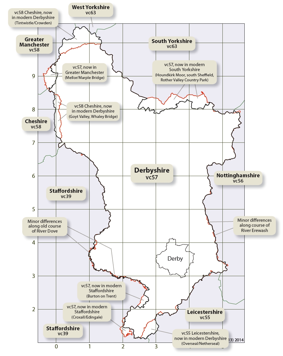
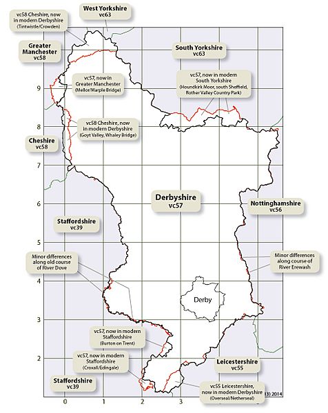
Image: Derbyshire county and vice-county comparison map
Description: Created for use in The Flora of Derbyshire (2015) - to whom this image should be credited - this map shows the major and minor differences between the modern-day, ceremonial, boundary of Derbyshire, and the Watsonian vice-county of Derbyshire (vc57) and of adjacent vice counties. Note: This work was created me, Parkywiki, using OpenSource map data, and that I am author of the Flora of Derbyshire and creator of all its mapped content. I request that any image acknowledgement is given to "The Flora of Derbyshire (2015)" and not to me via my username.
Title: Derbyshire county and vice-county comparison map
Credit: Ordnance Survey OpenData Vice-county boundary from National Biodiversity Network administrative boundary data from OS Boundary-Line product. vice-county also based on OS maps and can be used within the terms of the OS Open Data Licence see[1]
Author: The Flora of Derbyshire
Permission: This file is licensed under the Ordnance Survey OpenData License. In short: you are free to distribute and modify the file as long as you attribute the Ordnance Survey. Attribution: Contains Ordnance Survey data © Crown copyright and database right Note: Derivative works can be licensed under any Creative Commons Attribution 3.0 Licence. Ordnance Survey OpenData LicenceOS OpenDatahttps://www.ordnancesurvey.co.uk/business-and-government/licensing/using-creating-data-with-os-products/os-opendata.htmltrue
Usage Terms: Creative Commons Attribution-Share Alike 4.0
License: CC BY-SA 4.0
License Link: http://creativecommons.org/licenses/by-sa/4.0
Attribution Required?: Yes
Image usage
The following page links to this image:
