
Image: Descriptio Prime Tabulae Europae

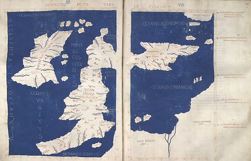
Description: The 1st Map of Europe: A Latin map of the British Isles (Insulae Britannicae): Ireland (Hybernia) and Britain (Alvion), based on Ptolemy's Geography. Note the positioning of Scotland at a right angle to the rest of Britain.
Title: Descriptio Prime Tabulae Europae
Credit: Harley MS 7182 ff 60v-61.
Author: Credited to Francesco di Antonio del Chierico in Florence; text Emanuel Chrysoloras and Jacobus Angelus's translation of Ptolemy's Geography
Permission: This is a faithful photographic reproduction of a two-dimensional, public domain work of art. The work of art itself is in the public domain for the following reason: Public domainPublic domainfalsefalse This work is in the public domain in its country of origin and other countries and areas where the copyright term is the author's life plus 100 years or fewer. You must also include a United States public domain tag to indicate why this work is in the public domain in the United States. This file has been identified as being free of known restrictions under copyright law, including all related and neighboring rights. https://creativecommons.org/publicdomain/mark/1.0/PDMCreative Commons Public Domain Mark 1.0falsefalse The official position taken by the Wikimedia Foundation is that "faithful reproductions of two-dimensional public domain works of art are public domain". This photographic reproduction is therefore also considered to be in the public domain in the United States. In other jurisdictions, re-use of this content may be restricted; see Reuse of PD-Art photographs for details.
Usage Terms: Public domain
License: Public domain
Attribution Required?: No
Image usage
The following 2 pages link to this image:
