
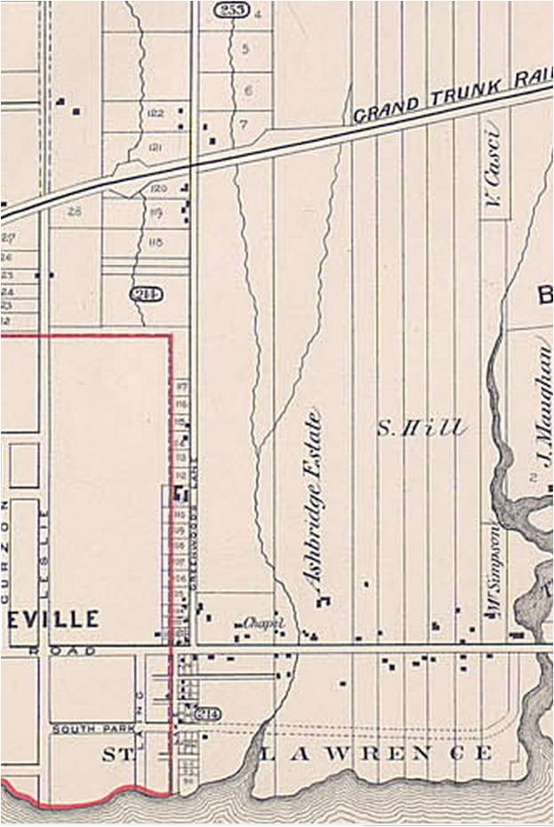
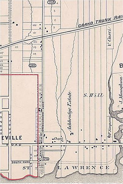
Image: Detail of an 1884 Goad's Atlas, showing Ashbridge's Creek
Description: Redwood Avenue marked the eastern boundary of the 1884 extension of the City of Toronto. Glencoe Avenue (now Glenside) ran through a brickyard, later used as a garbage dump. It was not filled in and used for housing until after World War II. In 1884 Goad’s Map shows everything east of the Ashbridge Estate to Coxwell as belonging to S. Hill (5 narrow farm fields formerly from east to west: Samuel Hill, Levi Ashbridge, Samuel Ashbridge, John Ashbridge, George Ashbridge.
Title: Detail of an 1884 Goad's Atlas, showing Ashbridge's Creek
Credit: https://leslievillehistory.com/craven-rd-fence/
Author: not stated
Permission: Public domainPublic domainfalsefalse This Canadian work is in the public domain in Canada because its copyright has expired due to one of the following: 1. it was subject to Crown copyright and was first published more than 50 years ago, or it was not subject to Crown copyright, and 2. it is a photograph that was created prior to January 1, 1949, or 3. the creator died more than 50 years ago. العربيَّة | čeština | Deutsch | English | español | suomi | français | italiano | 日本語 | 한국어 | македонски | മലയാളം | Nederlands | português | português do Brasil | sicilianu | +/−
Usage Terms: Public domain
License: Public domain
Attribution Required?: No
Image usage
The following page links to this image:
