
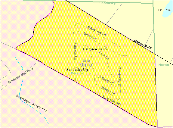
Image: Detailed map of Fairview Lanes, Ohio
No higher resolution available.
Detailed_map_of_Fairview_Lanes,_Ohio.png (575 × 425 pixels, file size: 19 KB, MIME type: image/png)
Description: Map of Fairview Lanes, a census-designated place (CDP) in Erie County, Ohio, United States, with its boundaries at the time of the 2000 census.
Title: Detailed map of Fairview Lanes, Ohio
Credit: http://factfinder.census.gov/leg2/63/120826463.gif, from http://factfinder.census.gov
Author: United States Census Bureau
Permission: This image or file is a work of a United States Census Bureau employee, taken or made as part of that person's official duties. As a work of the U.S. federal government, the image is in the public domain. English | Español | മലയാളം | Русский | Українська | +/−
Usage Terms: Public domain
License: Public domain
Attribution Required?: No
Image usage
The following page links to this image:

All content from Kiddle encyclopedia articles (including the article images and facts) can be freely used under Attribution-ShareAlike license, unless stated otherwise.