
Image: Detailed map of Portage Lakes, Ohio
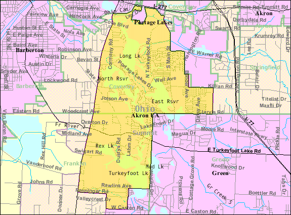
Description: Map of Portage Lakes, a census-designated place (CDP) in Summit County, Ohio, United States. Map reflects the CDP as it was in 2000; everything south of Woodcrest Avenue in the middle has since been annexed to the city of New Franklin.
Title: Detailed map of Portage Lakes, Ohio
Credit: http://factfinder.census.gov/leg2/88/120826488.gif, from http://factfinder.census.gov
Author: United States Census Bureau
Permission: This image or file is a work of a United States Census Bureau employee, taken or made as part of that person's official duties. As a work of the U.S. federal government, the image is in the public domain. English | Español | മലയാളം | Русский | Українська | +/−
Usage Terms: Public domain
License: Public domain
Attribution Required?: No
Image usage
The following page links to this image:
