
Image: Deutscher Bund
Size of this preview: 600 × 600 pixels. Other resolutions: 240 × 240 pixels | 2,362 × 2,362 pixels.
Original image (2,362 × 2,362 pixels, file size: 878 KB, MIME type: image/png)
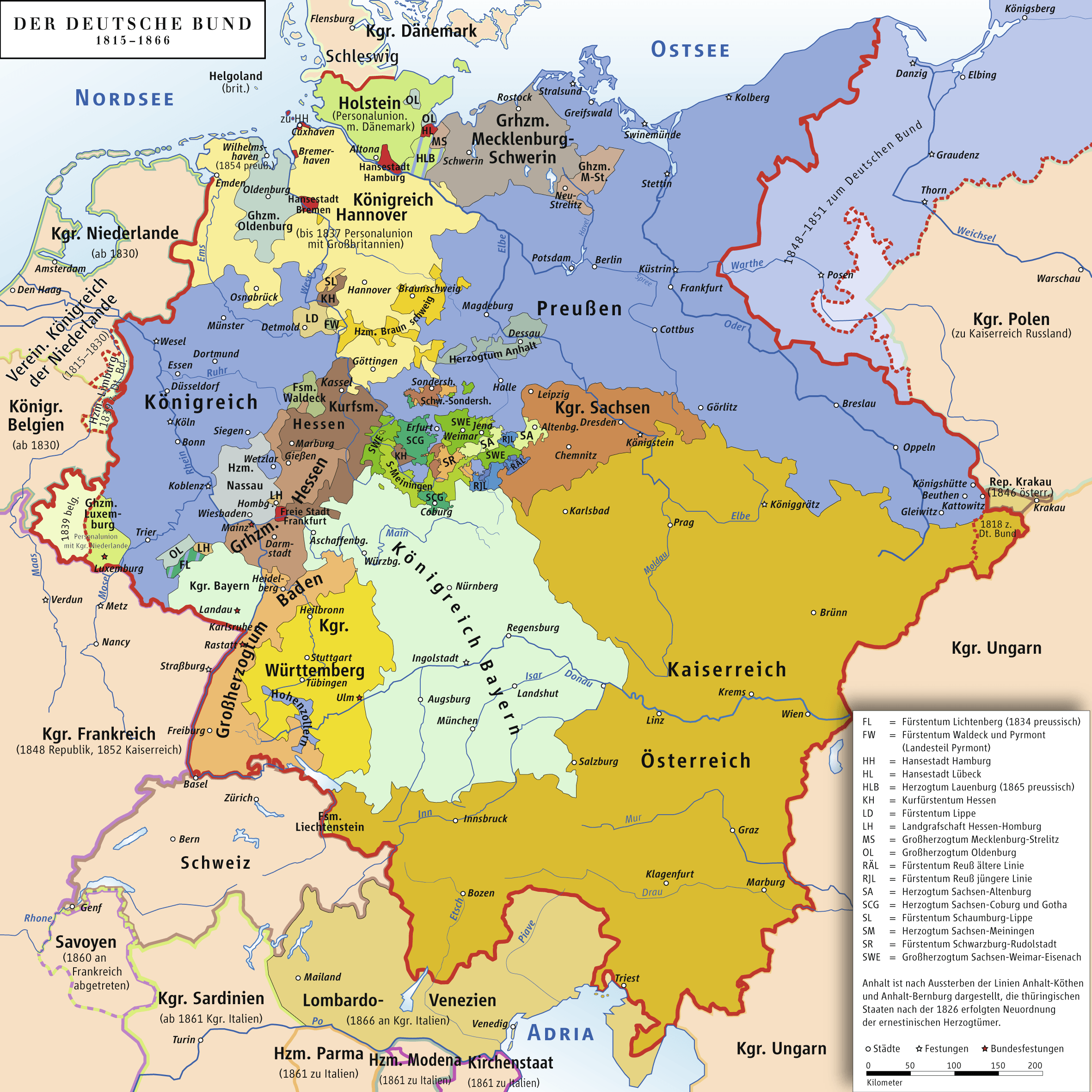
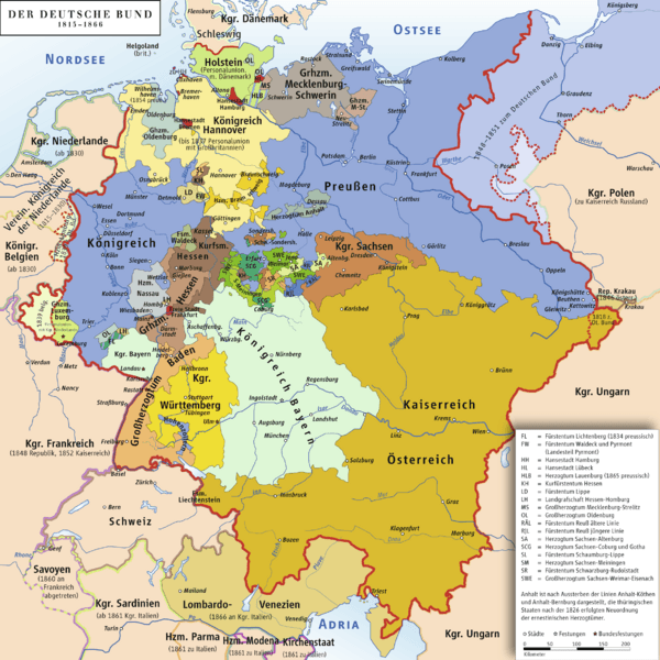
Description: Karte des Deutschen Bundes 1815–1866 / Map of German Confederation 1815–1866
Title: Deutscher Bund
Credit: own drawing/Source of Information: Putzger – Historischer Weltatlas, 89. Auflage, 1965
Author: ziegelbrenner
Permission: GNU FDL
Usage Terms: Creative Commons Attribution 2.5
License: CC BY 2.5
License Link: http://creativecommons.org/licenses/by/2.5
Attribution Required?: Yes
Image usage
The following page links to this image:

All content from Kiddle encyclopedia articles (including the article images and facts) can be freely used under Attribution-ShareAlike license, unless stated otherwise.