
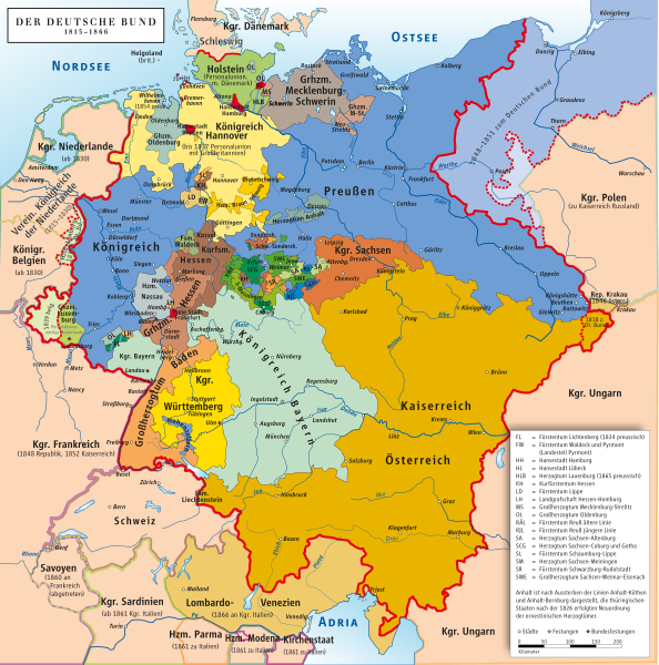
Image: Deutscher Bund

Description: Karte des Deutschen Bundes 1815–1866 / Map of German Confederation 1815–1866
Title: Deutscher Bund
Credit: Own work (Original text: own drawing/Source of Information: Putzger – Historischer Weltatlas, 89. Auflage, 1965; Westermanns Großer Atlas zur Weltgeschichte, 1969; Haacks geographischer Atlas. VEB Hermann Haack Geographisch-Kartographische Anstalt, Gotha/Leipzig, 1. Auflage, 1979; dtv-Atlas zur Weltgeschichte Band 1: Von den Anfängen bis zur Französischen Revolution; 23. Aufl. 1989, ISBN 3-423-03002-X)
Author: ziegelbrenner
Usage Terms: Creative Commons Attribution-Share Alike 3.0
License: CC BY-SA 3.0
License Link: http://creativecommons.org/licenses/by-sa/3.0/
Attribution Required?: Yes
Image usage
The following 2 pages link to this image:
