
Image: Deutsches Reich (Karte) Sachsen-Altenburg

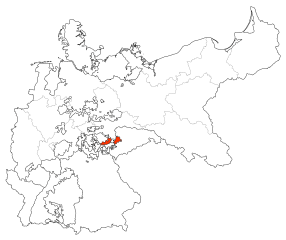
Description: Karte des Deutschen Reiches zu Anbeginn des 20. Jahrhunderts. Neben den einzelnen Gliedstaaten sind auch die preußischen Provinzen auf der Karte verzeichnet. Die Lage von Sachsen-Altenburg ist hervorgehoben.
Title: Deutsches Reich (Karte) Sachsen-Altenburg
Credit: Map based upon map data of the IEG-Maps project by Andreas Kunz, B. Johnen and Joachim Robert Moeschl of the University of Mainz. For further info visit: http://www.ieg-maps.uni-mainz.de
Author: David Liuzzo
Permission: This file is licensed under the Creative Commons Attribution-Share Alike 2.0 Germany license. You are free: to share – to copy, distribute and transmit the work to remix – to adapt the work Under the following conditions: attribution – You must attribute the work in the manner specified by the author or licensor (but not in any way that suggests that they endorse you or your use of the work). share alike – If you alter, transform, or build upon this work, you may distribute the resulting work only under the same or similar license to this one. http://creativecommons.org/licenses/by-sa/2.0/de/deed.en CC BY-SA 2.0 de Creative Commons Attribution-Share Alike 2.0 de truetrue
Usage Terms: Creative Commons Attribution-Share Alike 2.0 de
License: CC BY-SA 2.0 de
License Link: http://creativecommons.org/licenses/by-sa/2.0/de/deed.en
Attribution Required?: Yes
Image usage
There are no pages that link to this image.

_Sachsen-Altenburg.svg)