
Image: Domains of Fakhr al-Din in Ottoman Syria, at Zenith
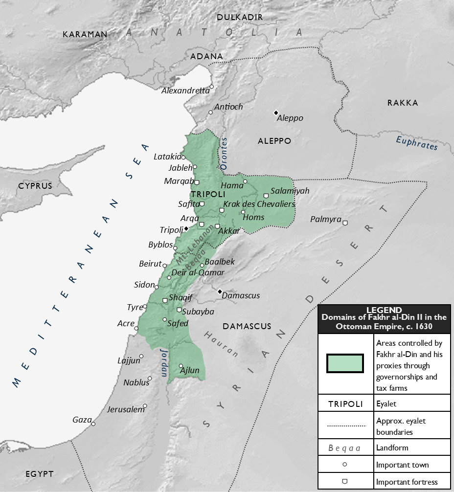
Description: A map depicting the territory (shaded in green) of the Druze emir and Ottoman governor and tax farmer, Fakhr al-Din II, at the zenith of his power, circa 1630. The territories represent the district (sanjak) and subdistrict (nahiye) governorships and tax farms (iltizam) held by Fakhr al-Din directly or indirectly through his family members and other proxies, including his aides, sons-in-law, or subordinate allies and kinsmen. The domains are located in the Ottoman provinces of the Levant, namely those of Damascus and Tripoli. Sources: Hourani, Alexander (2010) New Documents on the History of Mount Lebanon and Arabistan in the 10th and 11th Centuries H., Beirut, p. Map 26 (page 1,237) Harris, William (2012) Lebanon: A History, 600–2011, Category:New York: Oxford University Press ISBN: 978-0-19-518111-1.
Title: Domains of Fakhr al-Din in Ottoman Syria, at Zenith
Credit: Own work
Author: Al Ameer son
Usage Terms: Creative Commons Attribution-Share Alike 4.0
License: CC BY-SA 4.0
License Link: https://creativecommons.org/licenses/by-sa/4.0
Attribution Required?: Yes
Image usage
The following page links to this image:
