
Image: EU OCT and OMR map en

Size of this preview: 800 × 492 pixels. Other resolutions: 320 × 197 pixels | 2,206 × 1,358 pixels.
Original image (2,206 × 1,358 pixels, file size: 1 MB, MIME type: image/png)
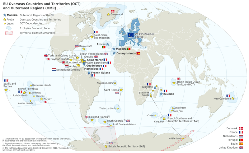
Description: Map of the EU - Overseas Countries and Territories (OCT) and Outermost Regions (OMR). This map shows the territorial scope of the Treaties of the EU as specified by Article 52 of the Treaty on European Union and Article 355 of the Treaty on the Functioning of the European Union.
Title: EU OCT and OMR map en
Credit: Natural Earth 1:50m (http://www.naturalearthdata.com)
Author: Alexrk2
Usage Terms: Creative Commons Attribution-Share Alike 3.0
License: CC BY-SA 3.0
License Link: http://creativecommons.org/licenses/by-sa/3.0
Attribution Required?: Yes
Image usage
The following 10 pages link to this image:

All content from Kiddle encyclopedia articles (including the article images and facts) can be freely used under Attribution-ShareAlike license, unless stated otherwise.