
Image: East Sussex UK location map

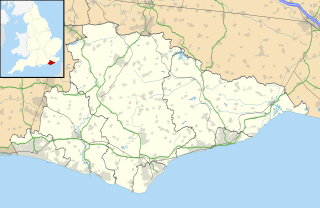
Description: Map of East Sussex, East Sussex, UK with the following information shown: Administrative borders Coastline, lakes and rivers Roads and railways Urban areas Equirectangular map projection on WGS 84 datum, with N/S stretched 155% Geographic limits: West: 0.28W East: 0.91E North: 51.2N South: 50.7N
Title: East Sussex UK location map
Credit: Ordnance Survey OpenData. Administrative borders and coastline data from Boundary-Line product. All other geographic data from Meridian 2 product. Inset derived from England location map.svg by Spischot.
Author: Nilfanion, created using Ordnance Survey data
Permission: This file is licensed under the Creative Commons Attribution-Share Alike 3.0 Unported license. Attribution: Contains Ordnance Survey data © Crown copyright and database right You are free: to share – to copy, distribute and transmit the work to remix – to adapt the work Under the following conditions: attribution – You must attribute the work in the manner specified by the author or licensor (but not in any way that suggests that they endorse you or your use of the work). share alike – If you alter, transform, or build upon this work, you may distribute the resulting work only under the same or similar license to this one. http://creativecommons.org/licenses/by-sa/3.0 CC BY-SA 3.0 Creative Commons Attribution-Share Alike 3.0 truetrue
Usage Terms: Creative Commons Attribution-Share Alike 3.0
License: CC BY-SA 3.0
License Link: http://creativecommons.org/licenses/by-sa/3.0
Attribution Required?: Yes
Image usage
The following 60 pages link to this image:
- All Souls Church, Hastings
- Anderitum
- Battle, East Sussex
- Bethel Strict Baptist Chapel, Robertsbridge
- Bethel Strict Baptist Chapel, Wivelsfield
- Bexhill-on-Sea
- Bodiam Castle
- Camber Castle
- Camber Sands
- Chailey Heritage Marine Hospital
- Charleston Farmhouse
- Church Street drill hall, Brighton
- Crowborough
- Crowborough Community Church
- Cuckmere Valley
- Ditchling Unitarian Chapel
- East Hoathly with Halland
- Five Ash Down Independent Chapel
- Hailsham
- Hammerwood
- Hampden Park, Eastbourne
- Hartfield
- Hastings Castle
- Heathfield, East Sussex
- Herstmonceux
- Hollingbury Castle
- Hove
- Lewes
- Lewes Castle
- Maresfield
- Michelham Priory
- Newhaven, East Sussex
- Newhaven Fort
- Newhaven Seaplane Base
- Nutley, East Sussex
- Otham Abbey
- Peacehaven
- Pevensey
- Pevensey Castle
- Polegate
- RAF Chailey
- Robertsbridge United Reformed Church
- Rye, East Sussex
- Rye Castle
- Saltdean
- Seaford, East Sussex
- South Street Free Church, Eastbourne
- St Andrew's Church, Alfriston
- St George's Church, Polegate
- St John the Evangelist's Church, St Leonards-on-Sea
- St Leonards-on-Sea
- St Mary's Church, Hampden Park, Eastbourne
- Telscombe
- Tide Mills, East Sussex
- Uckfield
- Uckfield Baptist Church
- Wadhurst
- Winchelsea
- Withyham
- Template:Location map United Kingdom East Sussex
