
Image: Easter Island map-en

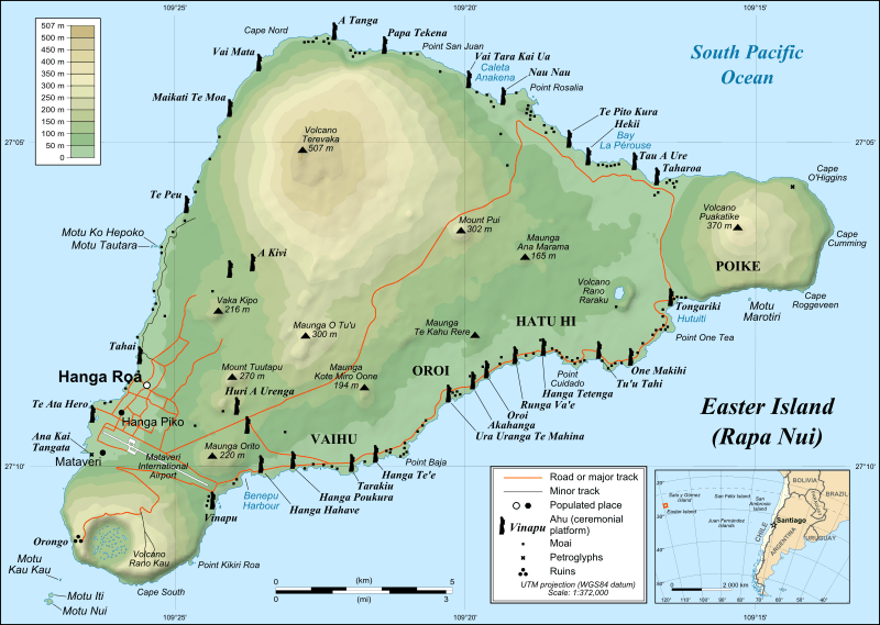
Description: Detailed topographic map in English of Easter Island
Title: Easter Island map-en
Credit: Own work Shorelines, ponds, roads, trails and airport drawn using Landsat 7 ETM+ imagery (public domain); Topography: NASA Shuttle Radar Topography Mission (SRTM3v2) (public domain); Main references used for the toponymy: prof. William Mulloy's map (easier to read here); Pacific Island Travel map (http://www.pacificislandtravel.com/easter_island/about_destin/isla_de_pascua[1].jpg); [1]
Author: Eric Gaba (Sting), translated by Bamse
Permission: Creative Commons: Share Alike – attribution required
Usage Terms: Creative Commons Attribution-Share Alike 2.5
License: CC BY-SA 2.5
License Link: http://creativecommons.org/licenses/by-sa/2.5
Attribution Required?: Yes
Image usage
The following 14 pages link to this image:
