
Image: Educational separation in the US prior to Brown Map

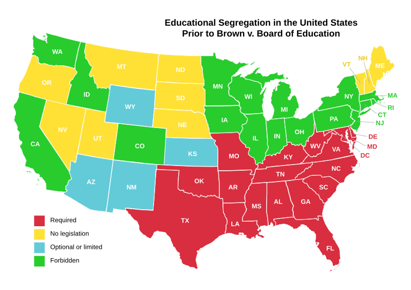
Description: Map of the United States, showing school segregation laws before the Supreme Court case of Brown v. Board of Education. Red means that segregation was required in that state. Blue states either allowed segregation in schools, but did not require it, or segregation was limited. Green states forbade segregation in schools. Yellow states had no legislation regarding segregation in schools.
Title: Educational separation in the US prior to Brown Map
Credit: Created by King of Hearts using information from Image:Educational seperation in the US prior to Brown Map.PNG (PD) and Image:Blank US Map.svg (GFDL) as a template.
Author: User:King_of_Hearts
Permission: This vector image was created with Inkscape.
Usage Terms: Creative Commons Attribution-Share Alike 3.0
License: CC-BY-SA-3.0
License Link: http://creativecommons.org/licenses/by-sa/3.0/
Attribution Required?: Yes
Image usage
