
Image: Eifel Münster, Sebastian-Eyfalia (1550-1628)
Size of this preview: 384 × 599 pixels. Other resolutions: 154 × 240 pixels | 1,892 × 2,950 pixels.
Original image (1,892 × 2,950 pixels, file size: 1.64 MB, MIME type: image/jpeg)
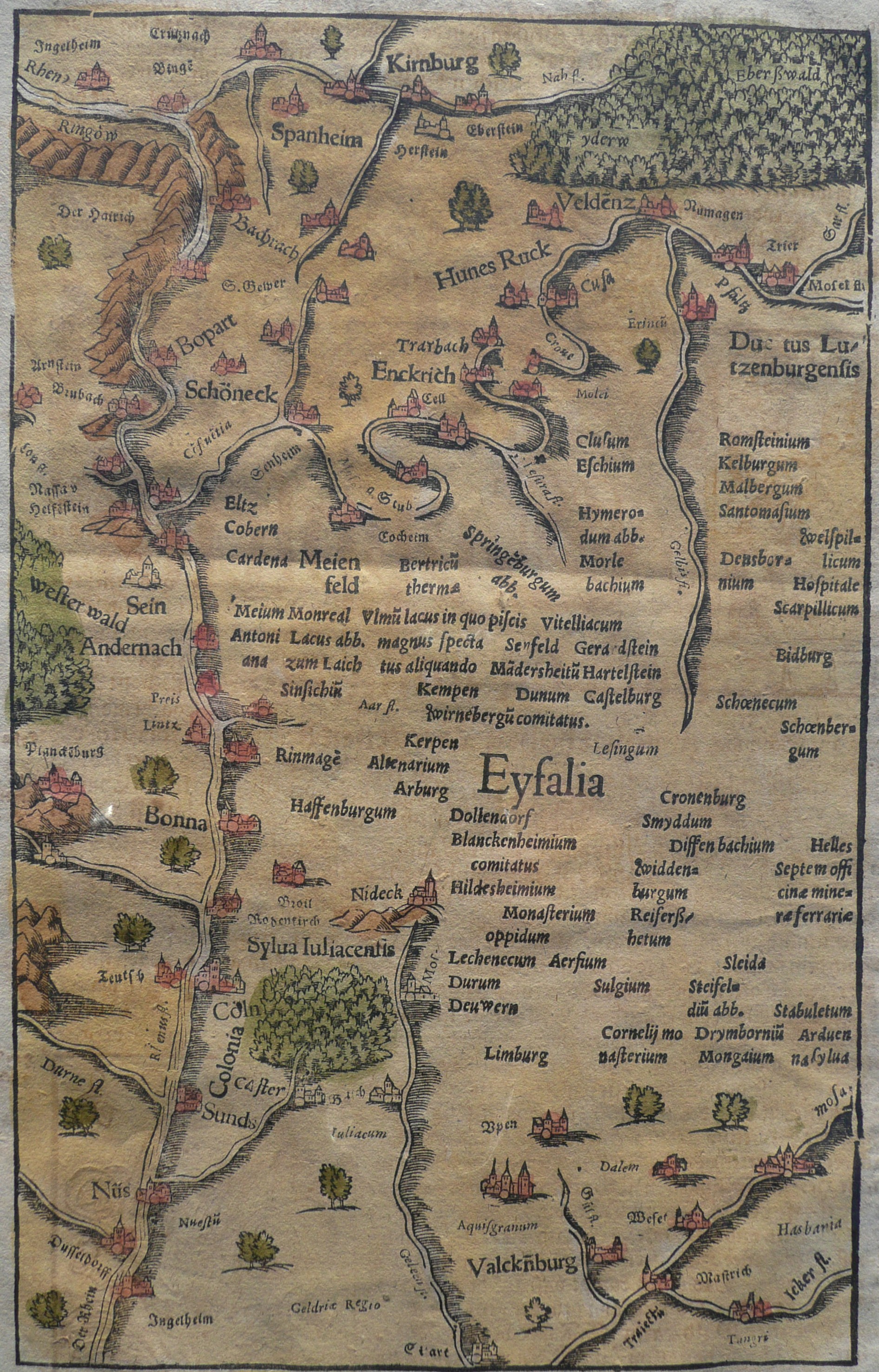
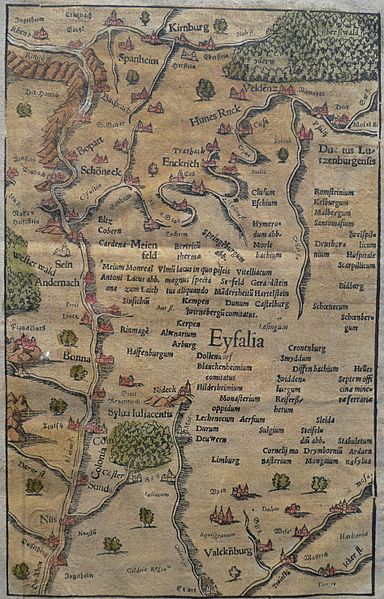
Description: Historical map of the region left of the middle reaches of the River Rhine, showing the Hunsrück and Eifel mountains and adjacent areas, published in 1628 (the first uncoloured version was published in 1550). Note that north is to the bottom.
Title: Eifel Münster, Sebastian-Eyfalia (1550-1628)
Credit: Cosmographia. Heinrich Petri, Basel 1628 (for full page scan of the cropped image see landkarten-sammeln.de: Sonderausstellung "Die Eifel im Bild alter Landkarten (1550 - 1750)": 1628 - Sebastian Münster : Die ander Tafel des Rheinstroms, begreiffend die Pfaltz, Westereich, Eyfel etc.)
Author: Sebastian Münster
Usage Terms: Public domain
License: Public domain
Attribution Required?: No
Image usage
The following page links to this image:

All content from Kiddle encyclopedia articles (including the article images and facts) can be freely used under Attribution-ShareAlike license, unless stated otherwise.
.jpg)