
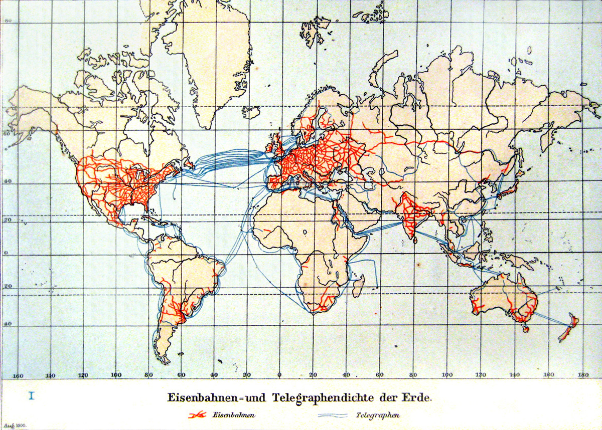
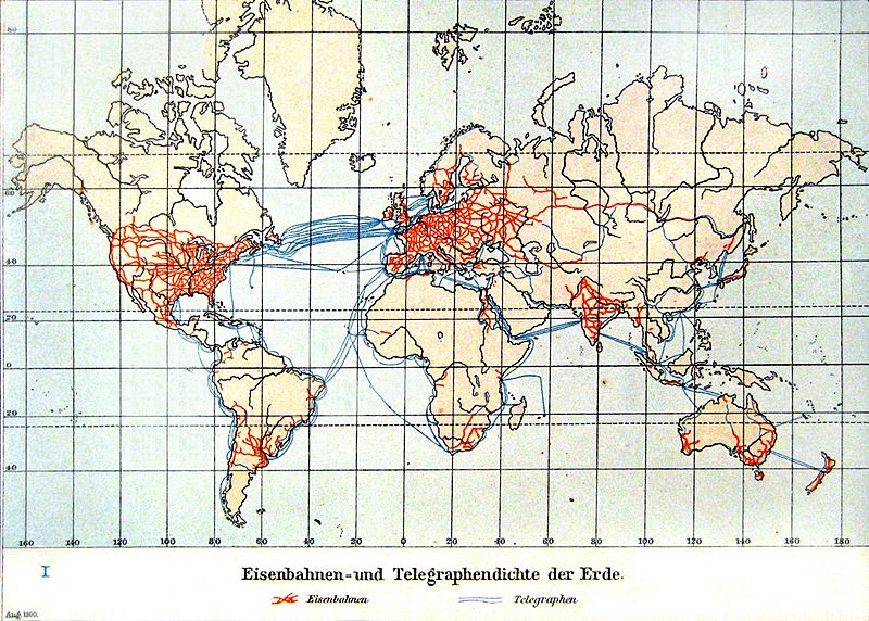
Image: Eisenbahnen- und Telegraphendichte der Erde um 1900
Size of this preview: 800 × 572 pixels. Other resolutions: 320 × 229 pixels | 1,200 × 858 pixels.
Original image (1,200 × 858 pixels, file size: 785 KB, MIME type: image/jpeg)
Description: World Map of the Railway and Telegraph Network Density at 1900. Copy from Andrees Handatlas 1901, S. 17 Kolonial- und Weltverkehrskarte
Title: Eisenbahnen- und Telegraphendichte der Erde um 1900
Credit: Andrees Handatlas, 4. Auflage
Author: Herausgegeben v. Albert Scobel
Usage Terms: Public domain
License: Public domain
Attribution Required?: No
Image usage
The following page links to this image:

All content from Kiddle encyclopedia articles (including the article images and facts) can be freely used under Attribution-ShareAlike license, unless stated otherwise.