
Image: Elkanah Tisdale, The Gerry-Mander Map, 1813 Cornell CUL PJM 1034 01
Size of this preview: 365 × 600 pixels. Other resolutions: 146 × 240 pixels | 3,000 × 4,929 pixels.
Original image (3,000 × 4,929 pixels, file size: 4.05 MB, MIME type: image/jpeg)
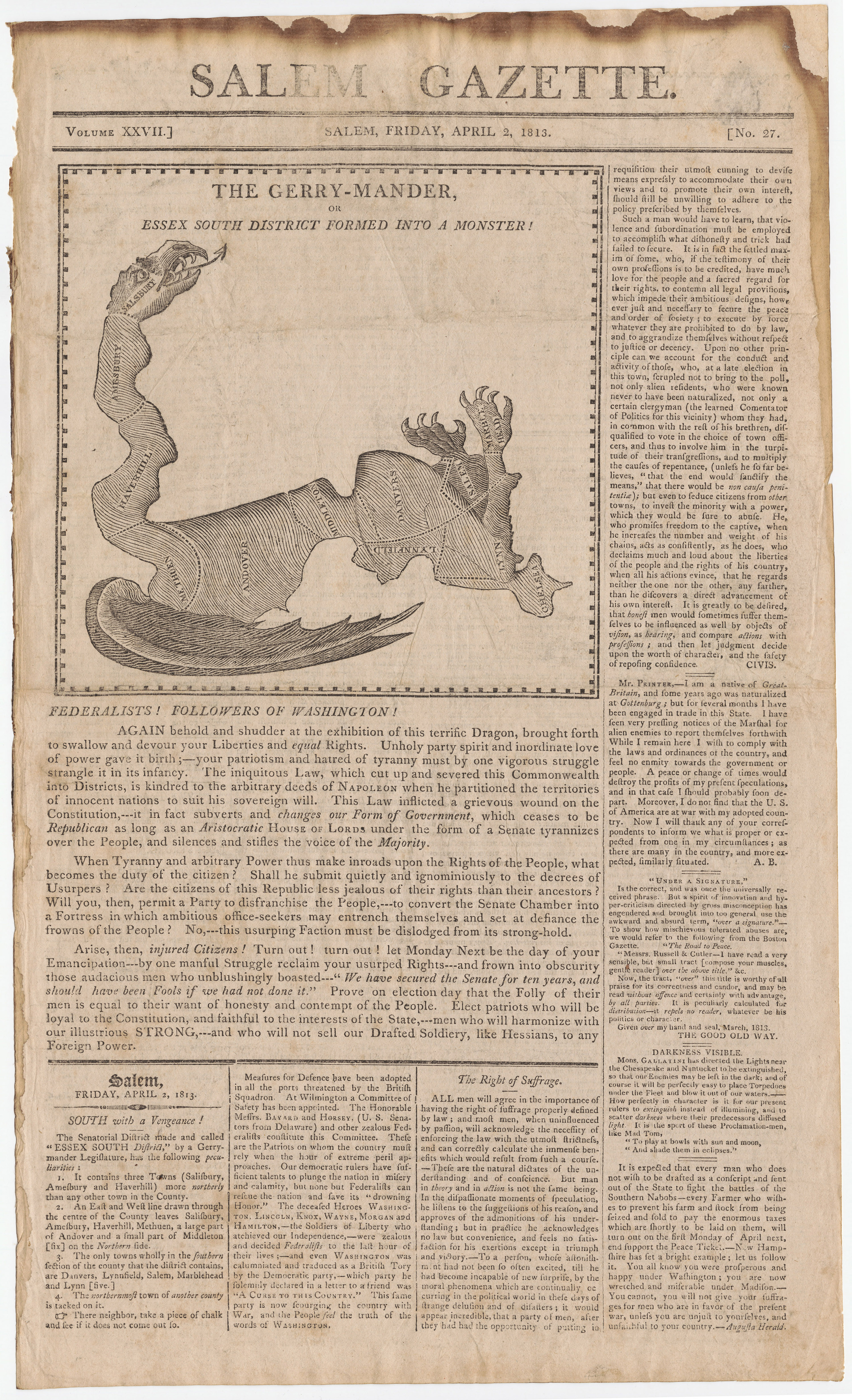
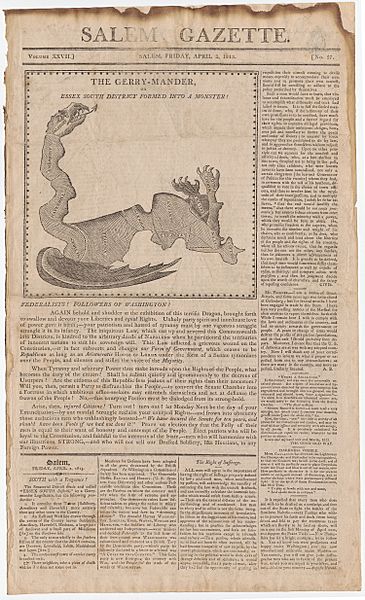
Description: This satirical map reflects the origin of the word "gerrymander", by Elkanah Tisdale in 1813.
Title: The Gerry-Mander Map Full TItle: The Gerry-Mander, or Essex South District Formed into a Monster!
Credit: Salem Gazette, Friday, April 2, 1813, page 1. Cornell University: Persuasive Cartography: The PJ Mode Collection
Author: Elkanah Tisdale
Usage Terms: Public domain
License: Public domain
Attribution Required?: No
Image usage
The following page links to this image:

All content from Kiddle encyclopedia articles (including the article images and facts) can be freely used under Attribution-ShareAlike license, unless stated otherwise.