
Image: Eq-prob
Size of this preview: 448 × 600 pixels. Other resolutions: 179 × 240 pixels | 535 × 716 pixels.
Original image (535 × 716 pixels, file size: 150 KB, MIME type: image/jpeg)
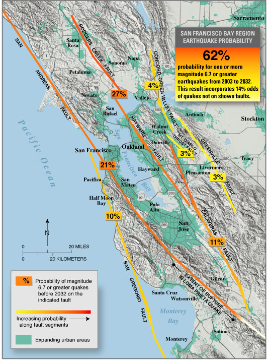
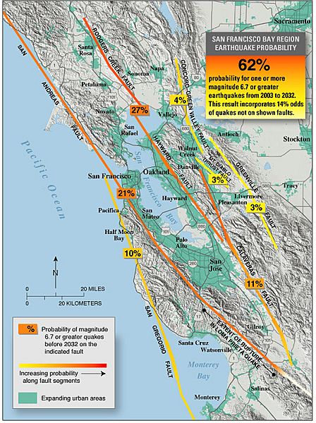
Description: en:USGS seismic hazard map showing the probability of an M6.7 or greater earthquake occurring in the en:San Francisco Bay Area between en:2003 and en:2032. Recent (January 2008) assessments (San Jose Mercury News: Hayward fault might be more dangerous than scientists thought ) suggest that the Hayward, Rodgers Creek, and northern Calaveras faults may be more likely to fail in the next few decades than previously thought (more so than is indicated on this map).
Title: Eq-prob
Usage Terms: Public domain
License: Public domain
Attribution Required?: No
Image usage
The following 3 pages link to this image:

All content from Kiddle encyclopedia articles (including the article images and facts) can be freely used under Attribution-ShareAlike license, unless stated otherwise.