
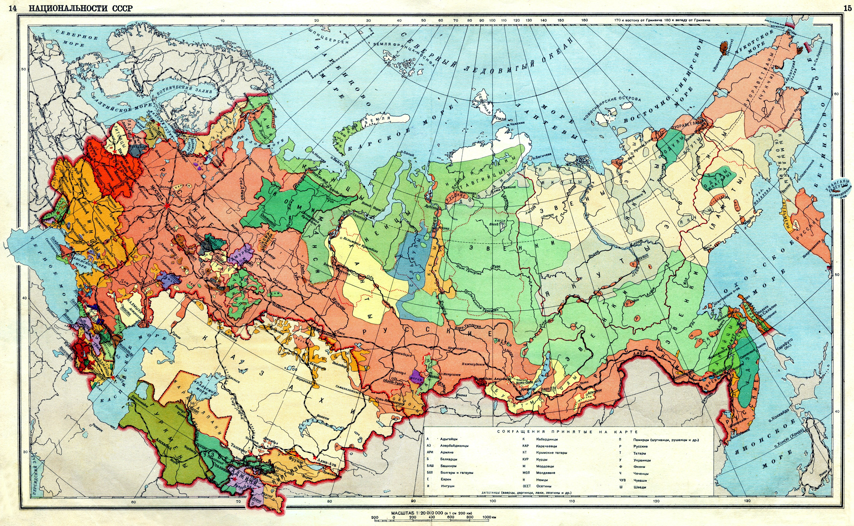
Image: Ethnic map USSR 1941
Size of this preview: 800 × 493 pixels. Other resolutions: 320 × 197 pixels | 3,560 × 2,194 pixels.
Original image (3,560 × 2,194 pixels, file size: 3.84 MB, MIME type: image/jpeg)
Description: Map of the ethnic group in the USSR in 1941
Title: Ethnic map USSR 1941
Credit: Географический атлас СССР для средней школы. Главное Управление Геодезии и Картографии при СНК СССР. Москва. 1941
Author: Riwnodennyk
Usage Terms: Public domain
License: Public domain
Attribution Required?: No
Image usage
The following page links to this image:

All content from Kiddle encyclopedia articles (including the article images and facts) can be freely used under Attribution-ShareAlike license, unless stated otherwise.