
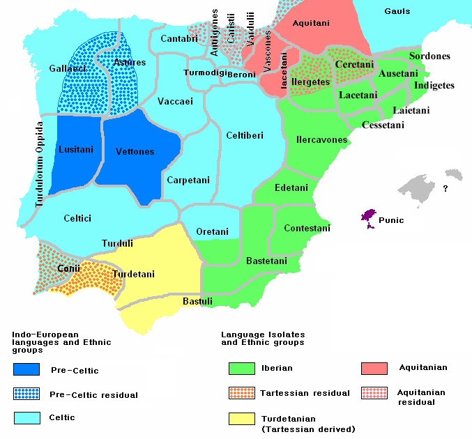
Image: Ethnographic Iberia 200 BCE
Description: Ethnographic and Linguistic Map of the Iberian Peninsula at about 200 BCE (at the end of the Second Punic War). Based on the map done by Portuguese Archeologist Luís Fraga (luisfraga@arqueotavira.com), from the "Campo Arqueológico de Tavira" (Tavira Archeological Camp - official site), in Tavira, Algarve - Portugal. The reference map can be found at this location, and a pdf version, with extensive and detailed information on the criteria used, as well as the long bibliography used to source the map can be found here.
Title: Ethnographic Iberia 200 BCE
Credit: self-made from Image:Blank-peninsula Iberica.png
Author: The Ogre
Usage Terms: GNU Free Documentation License
License: GFDL
License Link: http://www.gnu.org/copyleft/fdl.html
Attribution Required?: Yes
Image usage
The following 6 pages link to this image:
