
Image: Europäisches Nordmeer mit Grenzen
Size of this preview: 658 × 599 pixels. Other resolutions: 263 × 240 pixels | 989 × 901 pixels.
Original image (989 × 901 pixels, file size: 441 KB, MIME type: image/png)
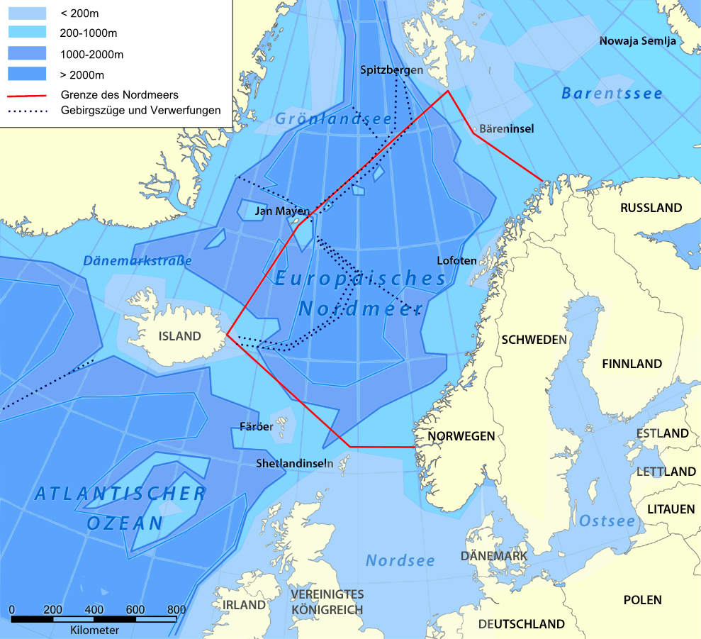
Description: Europäisches Nordmeer mit Grenzen und Tiefenangaben
Title: Europäisches Nordmeer mit Grenzen
Credit: Aus :Bild:Karte Europäisches Nordmeer.png (by NordNordWest) selbst gebastelt. Quelle: Der Grosse wissen.de-Weltatlas, Google Earth
Author: selber
Usage Terms: Creative Commons Attribution 3.0
License: CC BY 3.0
License Link: http://creativecommons.org/licenses/by/3.0
Attribution Required?: Yes
Image usage
The following 3 pages link to this image:

All content from Kiddle encyclopedia articles (including the article images and facts) can be freely used under Attribution-ShareAlike license, unless stated otherwise.