
Image: EuropeMap1328

Size of this preview: 552 × 600 pixels. Other resolutions: 221 × 240 pixels | 1,075 × 1,168 pixels.
Original image (1,075 × 1,168 pixels, file size: 1,012 KB, MIME type: image/png)
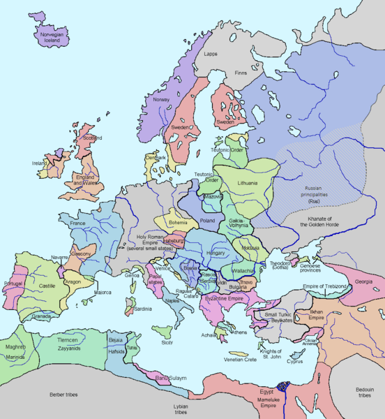
Description: 1328 history map — showing Europe in the 14th century, with adjacent Mediterranean regions of the Near East and North Africa.
Title: EuropeMap1328
Credit: Wikipedia
Author: Mascarinho10
Usage Terms: Creative Commons Attribution-Share Alike 3.0
License: CC BY-SA 3.0
License Link: https://creativecommons.org/licenses/by-sa/3.0
Attribution Required?: Yes
Image usage
There are no pages that link to this image.

All content from Kiddle encyclopedia articles (including the article images and facts) can be freely used under Attribution-ShareAlike license, unless stated otherwise.