
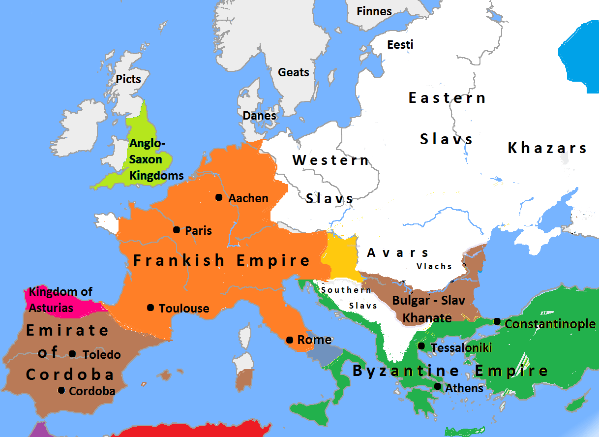
Image: Europe in 814, Charlemagne, Krum, Nicephorus I
Description: Map of Europe in 814
Title: Europe in 814, Charlemagne, Krum, Nicephorus I
Credit: Europe_plain_rivers.png The map is made according to: "World Atlas", part 3: Europe in Middle Ages, Larrouse, Paris, 2002, O. Renie Atlas "History of Bulgaria", Sofia, 1988, Bulgarian Academy of Sciences, V. Kamburova "World Atlas", N. Ostrovski, Rome, 1992, p.55 Атлас "История на средните векове", Sofia, 1982, G. Gavrilov "History in maps", Johannes Herder, Berlin, 1999, p. 20 "European Historical Globus", R. Rusev, 2006, p.117
Author: Stolichanin
Usage Terms: Creative Commons Attribution-Share Alike 3.0
License: CC BY-SA 3.0
License Link: http://creativecommons.org/licenses/by-sa/3.0
Attribution Required?: Yes
Image usage
There are no pages that link to this image.
