
Image: Ferndale Eureka RegionHistoricSeismicity
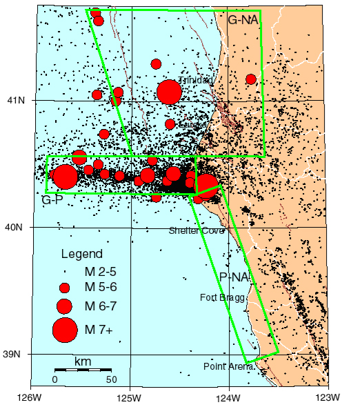
Description: Dots are from 1985-2003 earthquakes with magnitude greater than 2 near Eureka and Ferndale in northern California. Major roads in white; known active faults in brown. Green boxes refer to active plate interations G-NA = Gorda/North America Plates, G-P = Gorda/Pacific Plates and P-NA=Pacific/North America Plates.
Title: Ferndale Eureka RegionHistoricSeismicity
Credit: http://woodshole.er.usgs.gov/operations/obs/rmobs_pub/html/mendocino.html
Author: United States Geological Survey
Permission: This work is in the public domain in the United States because it is a work prepared by an officer or employee of the United States Government as part of that person’s official duties under the terms of Title 17, Chapter 1, Section 105 of the US Code. See Copyright. Note: This only applies to original works of the Federal Government and not to the work of any individual U.S. state, territory, commonwealth, county, municipality, or any other subdivision. This template also does not apply to postage stamp designs published by the United States Postal Service since 1978. (See § 313.6(C)(1) of Compendium of U.S. Copyright Office Practices). It also does not apply to certain US coins; see The US Mint Terms of Use. This file has been identified as being free of known restrictions under copyright law, including all related and neighboring rights.
Usage Terms: Public domain
License: Public domain
Attribution Required?: No
Image usage
The following page links to this image:
